- Altair Irvine, Irvine homes for sale
- Baker Ranch, Lake Forest homes for sale
- Chase Ranch, Corona homes for sale
- Eagle Glen, Corona homes for sale
- Foothill Ranch, Foothill Ranch homes for sale
- Hidden Ridge, Trabuco Canyon homes for sale
- Modjeska, Silverado homes for sale
- Mountain Gate, Corona homes for sale
- Orchard Hills, Irvine homes for sale
- Painted Trails, Mission Viejo homes for sale
- Palmia, Mission Viejo homes for sale
- Pavilion Park, Irvine homes for sale
- Portola Hills, Trabuco Canyon homes for sale
- Portola Springs, Irvine homes for sale
- Rainbow Ridge, Mission Viejo homes for sale
- Rancho Trabuco, Rancho Santa Margarita homes for sale
- South Corona, Corona homes for sale
- The Meadows, Lake Forest homes for sale
- The Retreat, Corona homes for sale
- Trabuco Canyon, Trabuco Canyon homes for sale
Silverado, CA - homes for sale
12 of 12 results displayed
- New
 $579,000Active2 beds 1 baths635 sq. ft.
14862 Wildcat Canyon Road, Silverado, CA 92676
MLS# PW26119405Listed by: FIRST TEAM REAL ESTATE 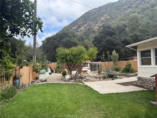 $835,000Active3 beds 1 baths1,192 sq. ft.
29300 Hazel Bell Drive, Silverado Canyon, CA 92676
MLS# OC26107551Listed by: BALBOA REAL ESTATE, INC $499,000Active0 Acres
30409 Silverado Canyon, Silverado Canyon, CA 92676
MLS# OC26082922Listed by: CURB $599,000Pending1 beds 1 baths572 sq. ft.
29145 Shadybrook, Silverado, CA 92676
MLS# PW26078464Listed by: FIRST TEAM REAL ESTATE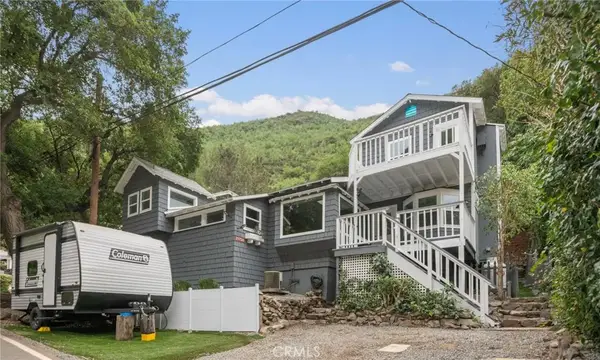 $775,000Active2 beds 1 baths1,310 sq. ft.
29734 Silverado Canyon Road, Silverado, CA 92676
MLS# SR26076240Listed by: KELLER WILLIAMS TEHACHAPI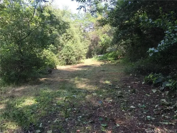 $149,999Active0 Acres
30242 Oak, Silverado Canyon, CA 92676
MLS# OC26068838Listed by: REALTY ONE GROUP WEST $750,000Active2 beds 1 baths978 sq. ft.
28344 Water Way, Silverado, CA 92676
MLS# OC26014156Listed by: COLDWELL BANKER REALTY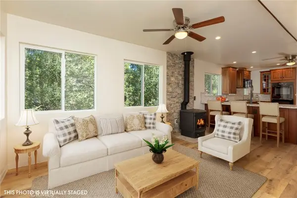 $899,000Active3 beds 2 baths1,871 sq. ft.
28181 Hidea Way, Silverado, CA 92676
MLS# OC26014130Listed by: COLDWELL BANKER REALTY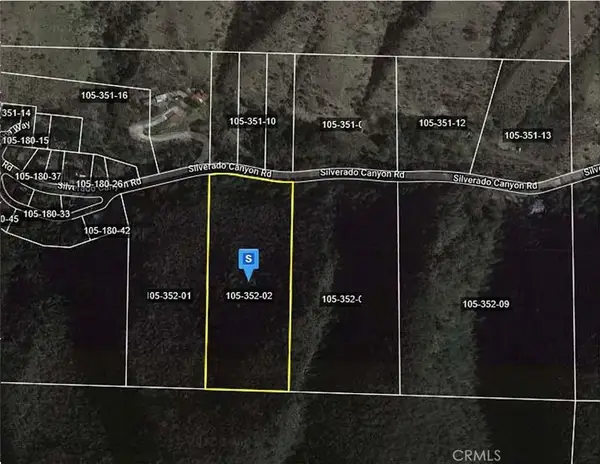 $175,000Active0 Acres
30792 Silverado Canyon, Silverado Canyon, CA 92676
MLS# OC26032916Listed by: LEGACY 15 REAL ESTATE BROKERS $560,500Active2 beds 1 baths1,230 sq. ft.
28751 Sycamore, Silverado, CA 92676
MLS# PW25266248Listed by: BONAVENTURE REALTORS $799,000Active8.41 Acres
29432 Silverado Canyon, Silverado Canyon, CA 92676
MLS# OC25264090Listed by: PACIFIC SOTHEBY'S INT'L REALTY $195,000Active6.72 Acres
0 Silverado Canyon Rd, Silverado Canyon, CA 92676
MLS# OC25257119Listed by: COLDWELL BANKER REALTY
Local realty services provided by:CENTURY 21 Affiliated, CENTURY 21 Fort Bragg Realty
This information is deemed reliable but not guaranteed. You should rely on this information only to decide whether or not to further investigate a particular property. BEFORE MAKING ANY OTHER DECISION, YOU SHOULD PERSONALLY INVESTIGATE THE FACTS (e.g. square footage and lot size) with the assistance of an appropriate professional. You may use this information only to identify properties you may be interested in investigating further. All uses except for personal, non-commercial use in accordance with the foregoing purpose are prohibited. Redistribution or copying of this information, any photographs or video tours is strictly prohibited. This information is derived from the Internet Data Exchange (IDX) service provided by San Diego MLS®. Displayed property listings may be held by a brokerage firm other than the broker and/or agent responsible for this display. The information and any photographs and video tours and the compilation from which they are derived is protected by copyright. Compilation © 2020 San Diego MLS®, Inc. SANDICOR Member Broker: Nikki Coppa
The information being provided by California Regional MLS (Southern California) is for the consumer's personal, non-commercial use and may not be used for any purpose other than to identify prospective properties consumer may be interested in purchasing. Any information relating to real estate for sale referenced on this web site comes from the Internet Data Exchange (IDX) program of the California Regional MLS (Southern California). CENTURY 21 Fort Bragg Realty is not a Multiple Listing Service (MLS), nor does it offer MLS access. This website is a service of CENTURY 21 Fort Bragg Realty, a broker participant of California Regional MLS (Southern California). This web site may reference real estate listing(s) held by a brokerage firm other than the broker and/or agent who owns this web site.
The accuracy of all information, regardless of source, including but not limited to open house information, square footages and lot sizes, is deemed reliable but not guaranteed and should be personally verified through personal inspection by and/or with the appropriate professionals. The data contained herein is copyrighted by California Regional MLS (Southern California) and is protected by all applicable copyright laws. Any unauthorized dissemination of this information is in violation of copyright laws and is strictly prohibited.
Copyright 2021 California Regional MLS (Southern California). All rights reserved. CRMLS Member Broker: Paul Clark
Neighborhoods near Silverado, CA
Zip codes near Silverado, CA
- 92602 homes for sale
- 92604 homes for sale
- 92610 homes for sale
- 92618 homes for sale
- 92620 homes for sale
- 92630 homes for sale
- 92676 homes for sale
- 92679 homes for sale
- 92688 homes for sale
- 92691 homes for sale
- 92692 homes for sale
- 92705 homes for sale
- 92782 homes for sale
- 92808 homes for sale
- 92869 homes for sale
- 92878 homes for sale
- 92879 homes for sale
- 92881 homes for sale
- 92882 homes for sale
- 92883 homes for sale
Popular searches near Silverado, CA
- Anaheim Hills homes for sale
- Corona homes for sale
- Coronita homes for sale
- Coto De Caza homes for sale
- El Cerrito homes for sale
- Foothill Ranch homes for sale
- Home Gardens homes for sale
- Irvine homes for sale
- Irvine-Lake Forest homes for sale
- Laguna Hills homes for sale
- Laguna Woods homes for sale
- Lake Forest homes for sale
- Las Flores homes for sale
- Mission Viejo homes for sale
- North Tustin homes for sale
- Rancho Santa Margarita homes for sale
- Temescal Valley homes for sale
- Trabuco Canyon homes for sale
- Tustin homes for sale
- Williams Canyon homes for sale
Protect your home and budget from life's surprises with an Assurant Home Warranty, backed by a partner that supports you through every step of homeownership. Explore Plans.
©2026 Century 21 Real Estate LLC. All rights reserved. CENTURY 21®, the CENTURY 21 Logo and C21® are service marks owned by Century 21 Real Estate LLC. Century 21 Real Estate LLC fully supports the principles of the Fair Housing Act and the Equal Opportunity Act. Each office is independently owned and operated. Listing information is deemed reliable but not guaranteed accurate.