- Barry Square, Hartford homes for sale
- Barry Square, Hartford homes for sale
- Behind The Rocks, Hartford homes for sale
- Behind the Rocks, Hartford homes for sale
- Downtown, Hartford homes for sale
- East Hartford Gardens, East Hartford homes for sale
- East Hartford Gardens, East Hartford homes for sale
- Frog Hollow, Hartford homes for sale
- Frog Hollow, Hartford homes for sale
- Hockanum, East Hartford homes for sale
- Hockanum, East Hartford homes for sale
- Parkville, Hartford homes for sale
- Parkville, Hartford homes for sale
- Sheldon, Hartford homes for sale
- South End, Hartford homes for sale
- South End, Hartford homes for sale
- South Green, Hartford homes for sale
- South Green, Hartford homes for sale
- South West, Hartford homes for sale
- South West, Hartford homes for sale
Wethersfield, CT - homes for sale
76 of 76 results displayed
- Coming Soon
 $349,000Coming Soon3 beds 2 baths
36 Oakdale Street, Wethersfield, CT 06109
MLS# 24179908Listed by: eXp Realty - New
 $429,900Active3 beds 1 baths1,558 sq. ft.
76 Collier Road, Wethersfield, CT 06109
MLS# 24179525Listed by: Coldwell Banker Realty - New
 $489,000Active4 beds 3 baths2,232 sq. ft.
46 Kimball Road, Wethersfield, CT 06109
MLS# 24179571Listed by: William Raveis Real Estate - New
 $169,900Active2 beds 1 baths854 sq. ft.
39 Mount Laurel Drive, Wethersfield, CT 06109
MLS# 24179312Listed by: Coldwell Banker Realty - New
 $399,999Active3 beds 3 baths2,144 sq. ft.
142 Wolcott Hill Road, Wethersfield, CT 06109
MLS# 24176855Listed by: Berkshire Hathaway NE Prop. - New
 $129,000Active1 beds 1 baths720 sq. ft.
53 Wolcott Hill Road #C12, Wethersfield, CT 06109
MLS# 24177432Listed by: Houlihan Lawrence - New
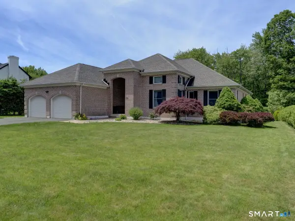
 $675,000Active4 beds 4 baths3,244 sq. ft.
46 Stonegate Drive, Wethersfield, CT 06109
MLS# 24178678Listed by: Coldwell Banker Realty - New
 $515,000Active3 beds 3 baths2,086 sq. ft.
107 Round Hill Road, Wethersfield, CT 06109
MLS# 24176384Listed by: Coldwell Banker Realty - New
 $775,000Active3 beds 4 baths3,572 sq. ft.
25 Amato Drive, Wethersfield, CT 06109
MLS# 24175535Listed by: Century 21 AllPoints Realty - New
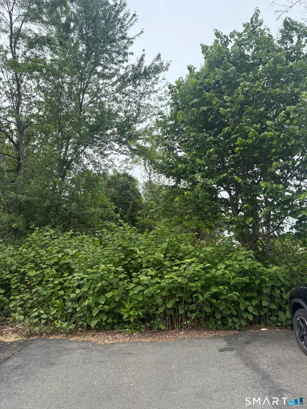 $30,000Active0.33 Acres
Middletown Avenue, Wethersfield, CT 06109
MLS# 24136017Listed by: Coldwell Banker Realty - New
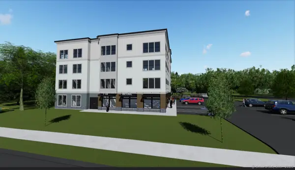 $1,500,000Active0.38 Acres
718 Silas Deane Highway, Wethersfield, CT 06109
MLS# 24176574Listed by: Francis Realty & Consulting 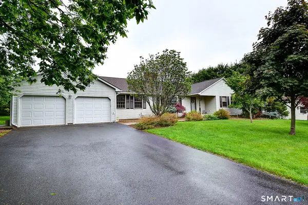 $499,900Pending3 beds 2 baths2,002 sq. ft.
80 Grist Mill Road, Wethersfield, CT 06109
MLS# 24176379Listed by: William Raveis Real Estate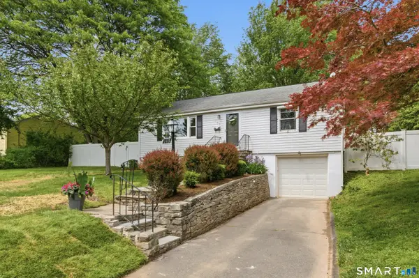 $429,900Pending4 beds 2 baths1,500 sq. ft.
149 Mill Street, Wethersfield, CT 06109
MLS# 24176648Listed by: Berkshire Hathaway NE Prop. $499,900Pending3 beds 3 baths1,381 sq. ft.
201 Ridge Crest Circle, Wethersfield, CT 06109
MLS# 24176824Listed by: eXp Realty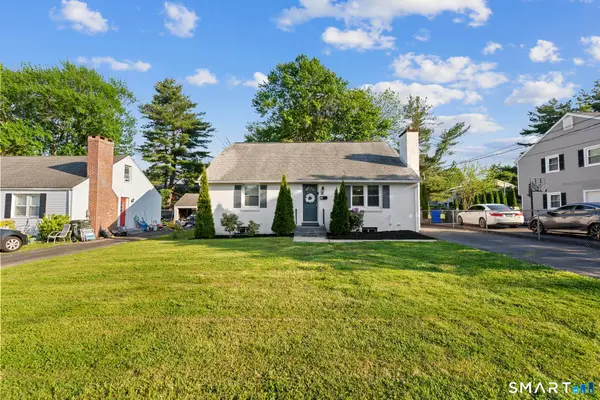 $419,900Pending4 beds 2 baths1,770 sq. ft.
81 Belcher Road, Wethersfield, CT 06109
MLS# 24176281Listed by: William Raveis Real Estate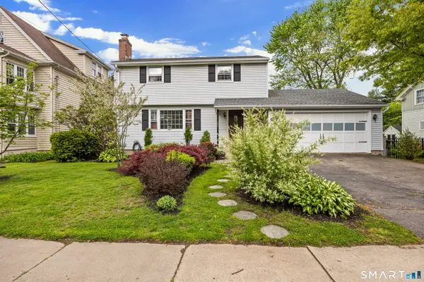 $529,000Active3 beds 3 baths1,720 sq. ft.
205 Garden Street, Wethersfield, CT 06109
MLS# 24174203Listed by: Lamacchia Realty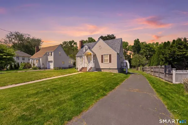 $339,000Pending4 beds 2 baths1,668 sq. ft.
124 Jordan Lane, Wethersfield, CT 06109
MLS# 24176814Listed by: Coldwell Banker Realty $489,900Active3 beds 2 baths1,970 sq. ft.
2 Morrison Avenue, Wethersfield, CT 06109
MLS# 24176181Listed by: William Raveis Real Estate $449,000Pending2 beds 2 baths2,081 sq. ft.
59 Thornbush Road, Wethersfield, CT 06109
MLS# 24173913Listed by: William Raveis Real Estate $595,000Active4 beds 2 baths1,872 sq. ft.
493 Main Street, Wethersfield, CT 06109
MLS# 24176653Listed by: Coldwell Banker Realty $360,000Pending3 beds 2 baths1,406 sq. ft.
20 Flower Street, Wethersfield, CT 06109
MLS# 24176419Listed by: Grace Group Realty LLC $329,900Pending3 beds 1 baths1,000 sq. ft.
35 Greenfield Street, Wethersfield, CT 06109
MLS# 24175800Listed by: Coldwell Banker Realty $225,000Pending2 beds 3 baths1,534 sq. ft.
18 Tabshey Court #18, Wethersfield, CT 06109
MLS# 24159997Listed by: KW Legacy Partners $450,000Pending3 beds 2 baths1,479 sq. ft.
44 Beverly Road, Wethersfield, CT 06109
MLS# 24172191Listed by: William Raveis Real Estate $349,900Pending2 beds 3 baths1,241 sq. ft.
43 Tinsmith Crossing #43, Wethersfield, CT 06109
MLS# 24174872Listed by: Century 21 AllPoints Realty $625,000Active4 beds 4 baths2,751 sq. ft.
101 Collier Road, Wethersfield, CT 06109
MLS# 24175203Listed by: William Raveis Real Estate $525,000Pending3 beds 2 baths1,972 sq. ft.
393 Main Street, Wethersfield, CT 06109
MLS# 24175130Listed by: Coldwell Banker Realty $399,900Pending3 beds 3 baths1,476 sq. ft.
127 Stillwold Drive, Wethersfield, CT 06109
MLS# 24174766Listed by: Coldwell Banker Realty $745,000Active3 beds 2 baths2,439 sq. ft.
501 Highland Street, Wethersfield, CT 06109
MLS# 24140936Listed by: Century 21 AllPoints Realty $640,000Pending5 beds 3 baths3,060 sq. ft.
72 Old Post Road, Wethersfield, CT 06109
MLS# 24173104Listed by: Berkshire Hathaway NE Prop. $365,000Pending2 beds 2 baths1,569 sq. ft.
597 Wolcott Hill Road, Wethersfield, CT 06109
MLS# 24174354Listed by: Simply Sold Real Estate $479,000Active3 beds 2 baths1,050 sq. ft.
25 Crystal Street, Wethersfield, CT 06109
MLS# 24173638Listed by: Five Stars Realty $610,000Pending5 beds 3 baths2,682 sq. ft.
62 Butternut Circle, Wethersfield, CT 06109
MLS# 24169474Listed by: Century 21 AllPoints Realty $659,900Pending4 beds 4 baths3,258 sq. ft.
152 Surrey Drive, Wethersfield, CT 06109
MLS# 24170727Listed by: William Raveis Real Estate $225,000Pending2 beds 2 baths1,134 sq. ft.
185 Spring Street #185, Wethersfield, CT 06109
MLS# 24173350Listed by: Century 21 Clemens Group $225,000Pending2 beds 2 baths1,223 sq. ft.
7 Sharon Lane #7, Wethersfield, CT 06109
MLS# 24172780Listed by: Showcase Realty, Inc. $550,000Active5 beds 2 baths2,454 sq. ft.
13 Wilcox Street, Wethersfield, CT 06109
MLS# 24171919Listed by: Eagle Eye Realty PLLC $499,900Pending4 beds 3 baths1,695 sq. ft.
32 Meadowgate Street, Wethersfield, CT 06109
MLS# 24169090Listed by: William Raveis Real Estate $585,000Active6 beds 2 baths2,828 sq. ft.
193-195 Wolcott Hill Road, Wethersfield, CT 06109
MLS# 24172867Listed by: Eagle Eye Realty PLLC $549,900Pending4 beds 3 baths2,228 sq. ft.
273 Dix Road, Wethersfield, CT 06109
MLS# 24172604Listed by: William Raveis Real Estate $549,900Pending4 beds 4 baths2,684 sq. ft.
25 Toll Gate Road, Wethersfield, CT 06109
MLS# 24172639Listed by: William Raveis Real Estate $369,000Pending4 beds 2 baths1,143 sq. ft.
51 Oakdale Street, Wethersfield, CT 06109
MLS# 24172408Listed by: Tea Leaf Realty $309,900Pending3 beds 2 baths991 sq. ft.
81 Crystal Street, Wethersfield, CT 06109
MLS# 24171542Listed by: William Pitt Sotheby's International Realty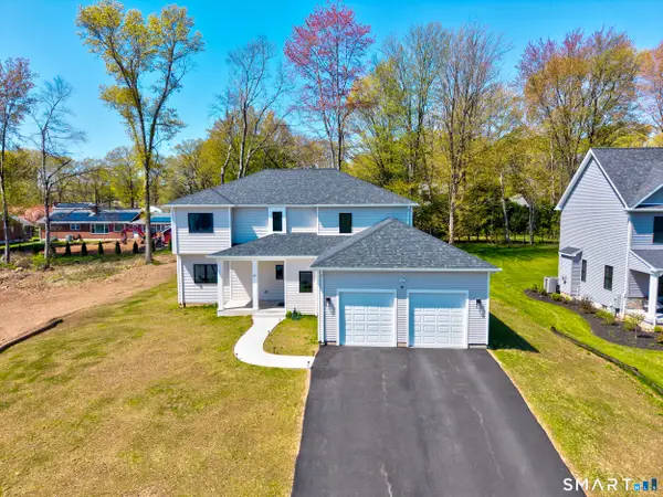 $1,149,900Active5 beds 4 baths3,554 sq. ft.
67 Luca Lane, Wethersfield, CT 06109
MLS# 24170390Listed by: eXp Realty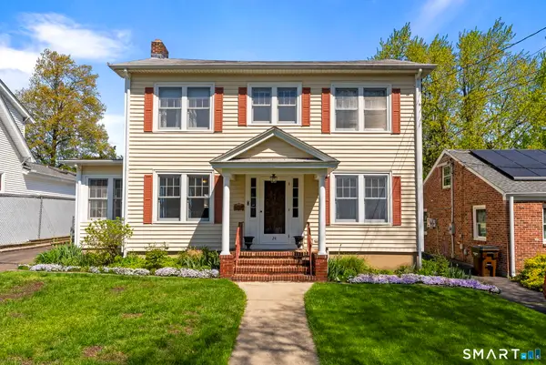 $405,900Pending3 beds 2 baths1,584 sq. ft.
24 Hillcrest Avenue, Wethersfield, CT 06109
MLS# 24170724Listed by: William Raveis Real Estate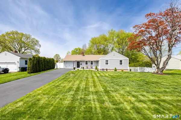 $499,000Pending3 beds 2 baths2,134 sq. ft.
129 Cloverdale Circle, Wethersfield, CT 06109
MLS# 24171059Listed by: Rockoff Realty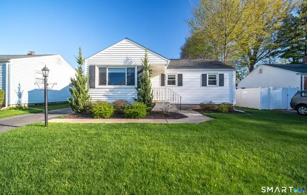 $379,900Pending2 beds 2 baths1,512 sq. ft.
86 Dudley Road, Wethersfield, CT 06109
MLS# 24170790Listed by: William Raveis Real Estate $409,900Pending4 beds 2 baths1,802 sq. ft.
105 Midwell Road, Wethersfield, CT 06109
MLS# 24171015Listed by: William Raveis Real Estate $330,000Pending3 beds 2 baths1,056 sq. ft.
41 Saxon Road, Wethersfield, CT 06109
MLS# 24170763Listed by: RE/MAX One $279,000Pending4 beds 2 baths1,550 sq. ft.
107 Coleman Road, Wethersfield, CT 06109
MLS# 24170480Listed by: Century 21 North East $299,000Pending2 beds 1 baths936 sq. ft.
76 Harding Street, Wethersfield, CT 06109
MLS# 24169872Listed by: Berkshire Hathaway NE Prop. $579,900Pending4 beds 2 baths2,064 sq. ft.
238 Broad Street, Wethersfield, CT 06109
MLS# 24170405Listed by: William Raveis Real Estate $631,111Active6 beds 4 baths2,156 sq. ft.
19-21 Mill Street, Wethersfield, CT 06109
MLS# 24169369Listed by: Century 21 AllPoints Realty $335,000Pending3 beds 1 baths888 sq. ft.
21 Brookside Circle, Wethersfield, CT 06109
MLS# 24169824Listed by: Premier Properties of CT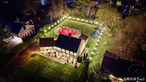 $779,000Pending4 beds 4 baths2,962 sq. ft.
508 Highland Street, Wethersfield, CT 06109
MLS# 24168091Listed by: Five Stars Realty $379,000Pending3 beds 1 baths1,472 sq. ft.
57 Concord Circle, Wethersfield, CT 06109
MLS# 24170850Listed by: Five Stars Realty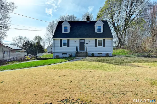 $379,900Pending3 beds 2 baths1,402 sq. ft.
492 Maple Street, Wethersfield, CT 06109
MLS# 24167512Listed by: KC Realty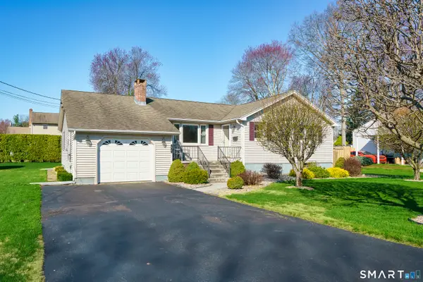 $419,900Pending2 beds 2 baths1,521 sq. ft.
43 Edward Street, Wethersfield, CT 06109
MLS# 24165119Listed by: Hagel & Assoc. Real Estate $259,900Active5.19 Acres
108 Chamberlain Lane, Glastonbury, CT 06033
MLS# 24131091Listed by: Red Castle Realty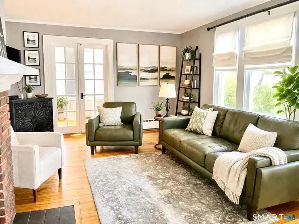 $499,000Pending4 beds 2 baths1,716 sq. ft.
31 Somerset Street, Wethersfield, CT 06109
MLS# 24164360Listed by: Dan Combs Real Estate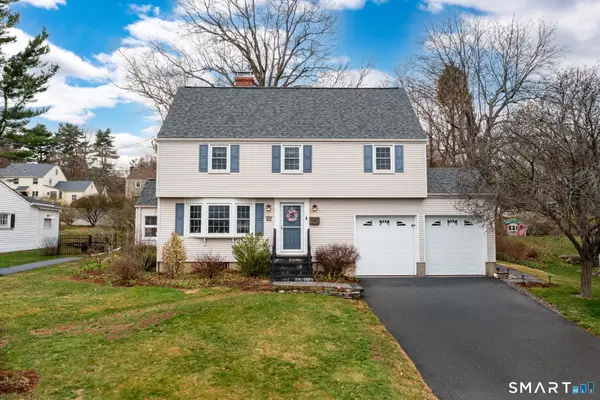 $489,900Pending4 beds 2 baths1,841 sq. ft.
63 Wells Farm Drive, Wethersfield, CT 06109
MLS# 24164885Listed by: Coldwell Banker Realty $399,900Pending3 beds 2 baths2,040 sq. ft.
146 Dudley Road, Wethersfield, CT 06109
MLS# 24162624Listed by: William Raveis Real Estate $285,000Pending3 beds 1 baths1,008 sq. ft.
1 Brussels Avenue, Wethersfield, CT 06109
MLS# 24162219Listed by: Houlihan Lawrence $185,000Pending2 beds 1 baths845 sq. ft.
70 Mountain Laurel Drive #70, Wethersfield, CT 06109
MLS# 24156540Listed by: William Pitt Sotheby's Int'l $399,000Pending3 beds 2 baths1,314 sq. ft.
158 Dix Road, Wethersfield, CT 06109
MLS# 24162617Listed by: Coldwell Banker Realty $595,000Active5 beds 3 baths2,986 sq. ft.
317-319 Garden Street, Wethersfield, CT 06109
MLS# 24156168Listed by: Eagle Eye Realty PLLC $249,900Pending2 beds 2 baths1,420 sq. ft.
147 Spring Street #147, Wethersfield, CT 06109
MLS# 24159396Listed by: Coldwell Banker Realty $865,000Pending4 beds 3 baths3,150 sq. ft.
5 Westmont Road, Wethersfield, CT 06109
MLS# 24157434Listed by: www.HomeZu.com $548,000Active3 beds 3 baths1,770 sq. ft.
91 Somerset Street, Wethersfield, CT 06109
MLS# 24152917Listed by: Coldwell Banker Realty $307,999Active2 beds 3 baths1,540 sq. ft.
7 Barrington Drive #APT C, Wethersfield, CT 06109
MLS# 24143679Listed by: Coldwell Banker Realty $850,000Pending4 beds 3 baths2,800 sq. ft.
155 Old Common Road, Wethersfield, CT 06109
MLS# 24140879Listed by: Cuoco & Co. Real Estate $399,000Pending3 beds 2 baths1,709 sq. ft.
19 Albert Avenue, Wethersfield, CT 06109
MLS# 24138866Listed by: Berkshire Hathaway NE Prop. $355,000Pending3 beds 2 baths1,408 sq. ft.
35 Stillwold Drive, Wethersfield, CT 06109
MLS# 24112835Listed by: Gorski Realty LLC $475,000Pending3 beds 2 baths2,168 sq. ft.
268 Fox Hill Road, Wethersfield, CT 06109
MLS# 24129216Listed by: William Raveis Real Estate $299,900Pending3 beds 1 baths912 sq. ft.
173 Timber Trail, Wethersfield, CT 06109
MLS# 24116658Listed by: Coldwell Banker Realty $719,900Pending4 beds 3 baths2,496 sq. ft.
76 Luca Lane Homesite 8, Wethersfield, CT 06109
MLS# 170566597Listed by: Coldwell Banker Realty
Local realty services provided by:CENTURY 21 Clemens Group
The data relating to real estate for sale on this website appears in part through the SMARTMLS Internet Data Exchange program, a voluntary cooperative exchange of property listing data between licensed real estate brokerage firms, and is provided by SMARTMLS through a licensing agreement. Listing information is from various brokers who participate in the SMARTMLS IDX program and not all listings may be visible on the site. The property information being provided on or through the website is for the personal, non-commercial use of consumers and such information may not be used for any purpose other than to identify prospective properties consumers may be interested in purchasing. Some properties which appear for sale on the website may no longer be available because they are for instance, under contract, sold or are no longer being offered for sale. Property information displayed is deemed reliable but is not guaranteed. Copyright 2026 SmartMLS, Inc.
Neighborhoods near Wethersfield, CT
Zip codes near Wethersfield, CT
- 06033 homes for sale
- 06051 homes for sale
- 06053 homes for sale
- 06067 homes for sale
- 06073 homes for sale
- 06103 homes for sale
- 06105 homes for sale
- 06106 homes for sale
- 06107 homes for sale
- 06108 homes for sale
- 06109 homes for sale
- 06110 homes for sale
- 06111 homes for sale
- 06112 homes for sale
- 06114 homes for sale
- 06117 homes for sale
- 06118 homes for sale
- 06119 homes for sale
- 06120 homes for sale
- 06416 homes for sale
Popular searches near Wethersfield, CT
- Cromwell homes for sale
- Cromwell homes for sale
- East Hartford homes for sale
- East Hartford homes for sale
- Glastonbury homes for sale
- Glastonbury homes for sale
- Glastonbury Center homes for sale
- Hartford homes for sale
- Hartford homes for sale
- Kensington homes for sale
- New Britain homes for sale
- New Britain homes for sale
- Newington homes for sale
- Newington homes for sale
- Rocky Hill homes for sale
- Rocky Hill homes for sale
- South Glastonbury homes for sale
- West Hartford homes for sale
- West Hartford homes for sale
- Wethersfield homes for sale
Protect your home and budget from life's surprises with an Assurant Home Warranty, backed by a partner that supports you through every step of homeownership. Explore Plans.
©2026 Century 21 Real Estate LLC. All rights reserved. CENTURY 21®, the CENTURY 21 Logo and C21® are service marks owned by Century 21 Real Estate LLC. Century 21 Real Estate LLC fully supports the principles of the Fair Housing Act and the Equal Opportunity Act. Each office is independently owned and operated. Listing information is deemed reliable but not guaranteed accurate.