- Clearbrook, Monroe Township homes for sale
- Colonial Oaks, East Brunswick homes for sale
- Concordia, Monroe Township homes for sale
- Dayton Square, Dayton homes for sale
- Englishtown, Englishtown homes for sale
- Fresh Impressions, Monmouth Junction homes for sale
- Greenbriar at Whittingham, Monroe Township homes for sale
- Kendall Park, Kendall Park homes for sale
- Kingswood Station, East Brunswick homes for sale
- Monroe Manor, Monroe Township homes for sale
- Parsonville, Bordentown homes for sale
- Princeton Landing, Plainsboro homes for sale
- Princeton Manor, Heathcote homes for sale
- Princeton Walk, Heathcote homes for sale
- Regency, Monroe Township homes for sale
- Rossmoor, Monroe Township homes for sale
- Summerfield, Dayton homes for sale
- The Grande at Monmouth Junction, Monmouth Junction homes for sale
- Village of Monmouth Junction, Monmouth Junction homes for sale
- Villagio, Monmouth Junction homes for sale
Hightstown, NJ - homes for sale
19 of 19 results displayed
- New
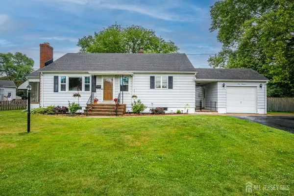
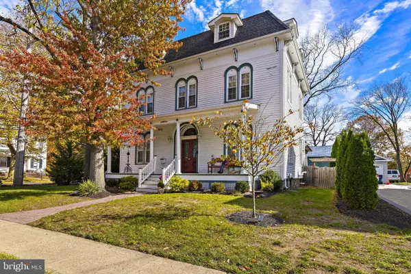
 $725,000Active3 beds 2 baths2,509 sq. ft.
3 Hight Blvd, HIGHTSTOWN, NJ 08520
MLS# NJME2078416Listed by: CENTURY 21 ABRAMS & ASSOCIATES, INC. - New
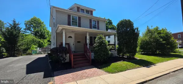 $525,000Active4 beds 1 baths1,401 sq. ft.
246 Franklin St, HIGHTSTOWN, NJ 08520
MLS# NJME2078396Listed by: BHHS FOX & ROACH - ROBBINSVILLE - New
 $499,990Active3 beds 2 baths1,200 sq. ft.
-113 Dutch Neck Road, Hightstown, NJ 08520
MLS# 2616597RListed by: KELLER WILLIAMS ELITE REALTORS - New
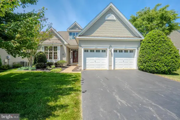
 $849,000Active5 beds 3 baths2,568 sq. ft.
3 Leshin Ln, HIGHTSTOWN, NJ 08520
MLS# NJME2077914Listed by: PUBLIC TRUST REALTY GROUP 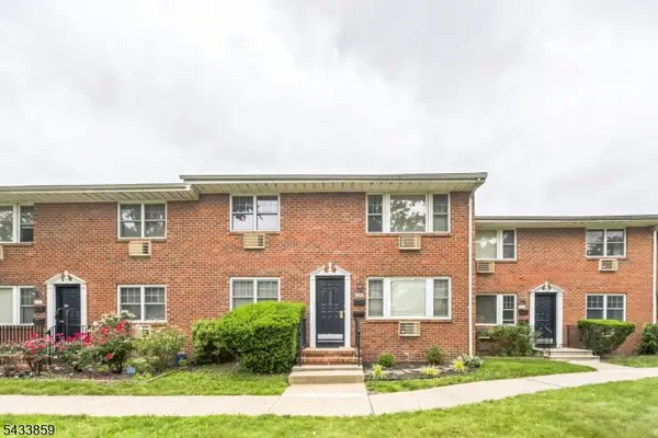 $155,000Active1 beds 1 baths
107-H The Orchards #H, East Windsor Twp., NJ 08520
MLS# 4029216Listed by: REALTY ONE GROUP PARAMOUNT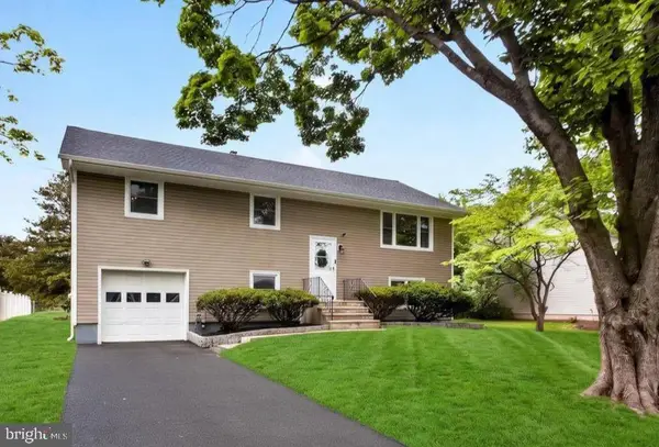 $639,900Pending4 beds 2 baths2,102 sq. ft.
216 Sunset Ave, HIGHTSTOWN, NJ 08520
MLS# NJME2077406Listed by: KELLER WILLIAMS REAL ESTATE - PRINCETON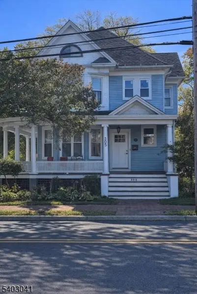 $559,000Active4 beds 3 baths
305 Stockton St, Hightstown Boro, NJ 08520
MLS# 4028216Listed by: REALTY ONE GROUP LEGEND $649,000Active4 beds 3 baths2,190 sq. ft.
220-a Wilson, HIGHTSTOWN, NJ 08520
MLS# NJME2075814Listed by: KELLER WILLIAMS REALTY WEST MONMOUTH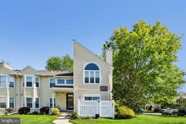 $325,000Active2 beds 2 baths1,160 sq. ft.
18 Dennis Ct, HIGHTSTOWN, NJ 08520
MLS# NJME2076678Listed by: EXP REALTY, LLC $342,000Active2 beds 2 baths1,160 sq. ft.
27 Huber Ct, HIGHTSTOWN, NJ 08520
MLS# NJME2075704Listed by: COLDWELL BANKER RESIDENTIAL BROKERAGE - PRINCETON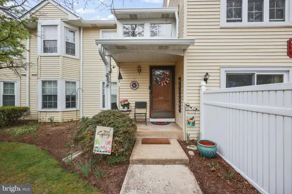 $325,000Active2 beds 2 baths1,160 sq. ft.
10 Fryer Ct, HIGHTSTOWN, NJ 08520
MLS# NJME2075452Listed by: EXP REALTY, LLC $367,000Pending4 beds 2 baths1,632 sq. ft.
365 Stockton St, HIGHTSTOWN, NJ 08520
MLS# NJME2075088Listed by: KELLER WILLIAMS CORNERSTONE REALTY- Open Sun, 1 to 4pm
 $918,000Active7 beds 4 baths4,253 sq. ft.
421 N Main, HIGHTSTOWN, NJ 08520
MLS# NJME2072708Listed by: EXP REALTY, LLC 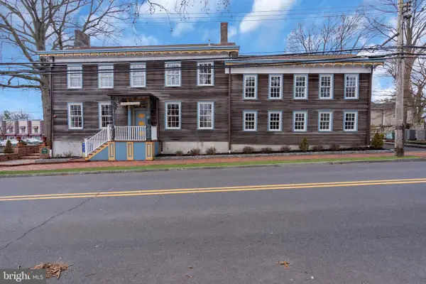 $924,900Active2 beds 2 baths3,800 sq. ft.
137-141 Stockton St, HIGHTSTOWN, NJ 08520
MLS# NJME2074400Listed by: KELLER WILLIAMS REAL ESTATE - NEWTOWN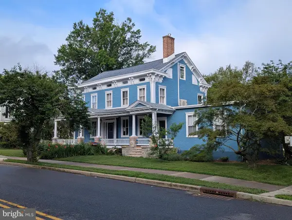 $895,000Active6 beds 5 baths4,000 sq. ft.
302 S Main St, HIGHTSTOWN, NJ 08520
MLS# NJME2074394Listed by: AUGHENBAUGH REALTY, LLC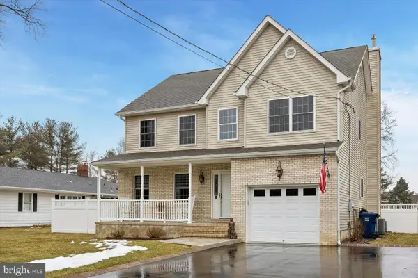 $699,999Pending4 beds 3 baths2,801 sq. ft.
244 Sunset Ave, HIGHTSTOWN, NJ 08520
MLS# NJME2073668Listed by: KELLER WILLIAMS PREMIER $410,000Active2 beds 1 baths840 sq. ft.
-4 Rocky Brook Court, Hightstown, NJ 08520
MLS# 2610668RListed by: GONZALEZ REALTY LLC $499,000Active3 beds 2 baths1,444 sq. ft.
336 Stockton St, HIGHTSTOWN, NJ 08520
MLS# NJME2070236Listed by: WEICHERT REALTORS-PRINCETON JUNCTION $525,000Active3 beds 2 baths1,441 sq. ft.
309 Lincoln Ave, HIGHTSTOWN, NJ 08520
MLS# NJME2067608Listed by: NEW JERSEY REALTY LLC
Local realty services provided by:CENTURY 21 Mertz & Associates, CENTURY 21 Charles Smith Agency, Inc.
The data relating to real estate for sale on this web-site comes in part from the Internet Listing Display database of the CENTRAL JERSEY MULTIPLE LISTING SYSTEM, INC. Real estate listings held by brokerage firms other than this site-owner are marked with the ILD logo. The CENTRAL JERSEY MULTIPLE LISTING SYSTEM, INC does not warrant the accuracy, quality, reliability, suitability, completeness, usefulness or effectiveness of any information provided. The information being provided is for consumers' personal, non-commercial use and may not be used for any purpose other than to identify properties the consumer may be interested in purchasing or renting. Copyright 2026, CENTRAL JERSEY MULTIPLE LISTING SYSTEM, INC. All rights reserved”. The CENTRAL JERSEY MULTIPLE LISTING SYSTEM, INC retains all rights, title and interest in and to its trademarks, service marks and copyrighted material.
The data relating to real estate for sale on this website comes in part from the IDX Program of Garden State Multiple Listing Service, L.L.C. Real estate listings held by other brokerage firms are marked as IDX Listing. Information deemed reliable but not guaranteed. 2026 Garden State Multiple Listing Service, L.L.C. All rights reserved. Notice: The dissemination of listings on this website does not constitute the consent required by N.J.A.C. 11:5.6.1 (n) for the advertisement of listings exclusively for sale by another broker. Any such consent must be obtained in writing from the listing broker. This information is being provided for Consumers' personal, non-commercial use and may not be used for any purpose other than to identify prospective properties Consumers may be interested in purchasing. Date Last Updated June 5, 2026
Neighborhoods near Hightstown, NJ
Zip codes near Hightstown, NJ
- 07726 homes for sale
- 08501 homes for sale
- 08510 homes for sale
- 08512 homes for sale
- 08514 homes for sale
- 08520 homes for sale
- 08528 homes for sale
- 08535 homes for sale
- 08536 homes for sale
- 08542 homes for sale
- 08550 homes for sale
- 08555 homes for sale
- 08619 homes for sale
- 08620 homes for sale
- 08690 homes for sale
- 08691 homes for sale
- 08810 homes for sale
- 08828 homes for sale
- 08831 homes for sale
- 08852 homes for sale
Popular searches near Hightstown, NJ
- Clearbrook homes for sale
- Concordia homes for sale
- Cranbury township homes for sale
- Cranbury homes for sale
- East Windsor homes for sale
- Encore at Monroe homes for sale
- Monroe Manor homes for sale
- Plainsboro homes for sale
- Plainsboro Center homes for sale
- Princeton Meadows homes for sale
- Renaissance at Monroe homes for sale
- Robbinsville Twp homes for sale
- Robbinsville homes for sale
- Roosevelt homes for sale
- Rossmoor homes for sale
- Stonebridge homes for sale
- The Ponds homes for sale
- Twin Rivers homes for sale
- West Windsor Township homes for sale
- Whittingham homes for sale
Protect your home and budget from life's surprises with an Assurant Home Warranty, backed by a partner that supports you through every step of homeownership. Explore Plans.
©2026 Century 21 Real Estate LLC. All rights reserved. CENTURY 21®, the CENTURY 21 Logo and C21® are service marks owned by Century 21 Real Estate LLC. Century 21 Real Estate LLC fully supports the principles of the Fair Housing Act and the Equal Opportunity Act. Each office is independently owned and operated. Listing information is deemed reliable but not guaranteed accurate.