CR 3230 and 3233, Clarksville, TX 75426
Local realty services provided by:CENTURY 21 A Select Group
CR 3230 and 3233,Clarksville, TX 75426
$100,965
- 12.7 Acres
- Lots / Land
- Active
Listed by: mark brian, mark brian
Office: terrastone land company
MLS#:20253193
Source:TX_LAAR
Price summary
- Price:$100,965
About this home
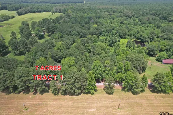
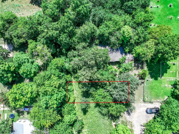
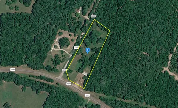
NEW PRICE REDUCTION - UNRESTRICTED - Red River County is located within an hour or so from major cities and offers a reprieve from the noise of urban life, almost like stepping back in time. The drive from US 82 at Clarksville winds northeast on FM 1159 for 10 miles, passing pastures, row crop farms and forests on the way. Five minutes on maintained county roads brings you to the property near early Texas settlements of Pecan Point, Mound City and Vessey. This land is cloaked in native forests that have naturally reforested once busy farmsteads. The remnants of these farms are nestled in woods now, the work of previous farming of the land now exist as cherished family memories. Plow furrows are still visible in places, some of the current owners worked the farm for their grandparents during summers. There are very large old trees that once were scattered in the old fields that now stand in contrast to the younger trees as reminders of what this landscape once was. The soils were used in the past to grow crops and for pasture. Current conditions on the property make it suitable for forestry management, with favorable species of hardwood along with the pine. Recreational activities such as hunting, ATV riding or walking the woods could work with a residence or weekend getaway. Allowing the forest to grow over time while using it recreationally would be a good plan for this land. Since a 2001 thinning harvest the regrowth has produced another crop of trees. The forest understory is opening up as shade suppresses the brush, revealing a fairly open forest in most places. Schaffline Creek cuts across the southwest corner of the 44.8 acres, smaller Tanyard Branch runs along the northeastern boundary of the 12.7 acre parcel. Several wet-weather branches on the 44.8 and 32.8 acre parcels lead south into the six or seven total acres of bottomland. This farm is offered in seven parcels that will have county road access. See Proposed Parcel Mapping and Parcel Pricing Table in the documents. Land is for sale as individual parcels as shown on the parcel mapping, or a combination of 2 or more into larger parcels; but no subdivided smaller parcels. Division lines between parcels have not been surveyed; mapping is provided as an illustration of the Sellers intent. County roads and/or exterior boundaries define the 20.7, 12.2 and 12.7 acres. The access corridor for the 32.8 acres is intended to be approximately 75 feet wide. Entire 154.222 acres surveyed in April 2024, plat available upon request. Acreages of parcels are estimated, based on Appraisal District, aerial photos, deed call information & ground checks. Sellers are reserving all owned mineral rights. FEMA flood zones not mapped in this county. Railroad Commission data shows no pipelines, oil or gas wells. Taxes for 2024 were $122.48 for the 154 acres. The property is currently under Ag/Timber. New Owner will be responsible to verify tax status, rollback provisions, and/or apply for Ag/Timber Valuation at the Appraisal District. Electric Power - powerline along northern boundary of the 20.7 acre parcel, and along east side of CR 3230, running NE to SW across the 12.7, 12.2, 14.1 and 44.8 acre parcels. There will be a reservation for utility right-of-way on CR 3233 on boundary between 12.2 and 14.1 acre parcels for utility access to 16.9 and 32.8 acres. Service drops and connections will be the responsibility of the Buyer. Lamar Electric Cooperative 903-784-4303. Telephone landline is indicated along CR 3230, it is believed to be Windstream. Septic system / water well will need to be installed responsibility of buyer....
Contact an agent
Home facts
- Listing ID #:20253193
- Added:437 day(s) ago
- Updated:July 21, 2026 at 02:40 PM
Structure and exterior
- Lot area:12.7 Acres
Finances and disclosures
- Price:$100,965
- Tax amount:$122
New listings near CR 3230 and 3233
- New
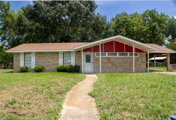 $135,900Active3 beds 1 baths1,422 sq. ft.
1307 S Delaware Street, Clarksville, TX 75426
MLS# 21335459Listed by: CENTURY 21 HARVEY PROPERTIES-P - New
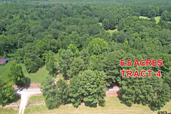
 $65,000Active-- beds -- baths
Tract 4 County Road 3117, Clarksville, 75426
MLS# 26009840Listed by: CENTURY 21 LAKE COUNTRY-QUITMN - New
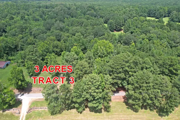 $45,000Active3 Acres
Tract 3 County Road 3117, Clarksville, TX 75426
MLS# 21331786Listed by: CENTURY 21 LAKE COUNTRY - New
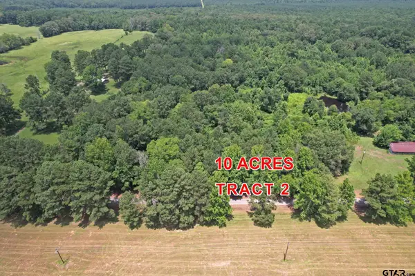 $95,000Active-- beds -- baths
Tract 2 County Road 3117, Clarksville, 75426
MLS# 26009835Listed by: CENTURY 21 LAKE COUNTRY-QUITMN - New
 $75,000Active-- beds -- baths
Tract 1 County Road 3117, Clarksville, 75426
MLS# 26009805Listed by: CENTURY 21 LAKE COUNTRY-QUITMN - New
 $10,000Active0.11 Acres
TBD W Taylor Street, Clarksville, TX 75426
MLS# 21330306Listed by: CENTURY 21 FIRST GROUP - New
 $39,999Active3.07 Acres
10146 Fm 1699, Clarksville, TX 75426
MLS# 21328074Listed by: PLATLABS, LLC 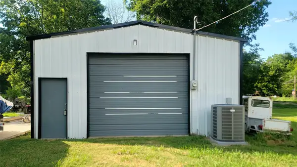 $125,000Active0.46 Acres
805 S Walnut, Clarksville, TX 75426
MLS# 21315074Listed by: GLASS LAND AND HOME LLC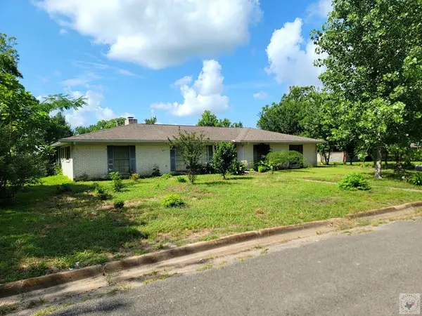 $150,000Active3 beds 2 baths2,520 sq. ft.
706 W Fourth, Clarksville, TX 75426
MLS# 205457Listed by: Glass Land and Home LLC $35,000Active2 beds 1 baths1,296 sq. ft.
1105 S Donoho Street, Clarksville, TX 75426
MLS# 21318546Listed by: CENTURY 21 HARVEY PROPERTIES-P
Protect your home and budget from life's surprises with an Assurant Home Warranty, backed by a partner that supports you through every step of homeownership. Explore Plans.
©2026 Century 21 Real Estate LLC. All rights reserved. CENTURY 21®, the CENTURY 21 Logo and C21® are service marks owned by Century 21 Real Estate LLC. Century 21 Real Estate LLC fully supports the principles of the Fair Housing Act and the Equal Opportunity Act. Each office is independently owned and operated. Listing information is deemed reliable but not guaranteed accurate.