- Adams Boulevard, Saginaw homes for sale
- Banks, Bay City homes for sale
- Butman, Saginaw homes for sale
- Cathedral District, Saginaw homes for sale
- Center Avenue, Bay City homes for sale
- Columbus Avenue, Bay City homes for sale
- Coulter, Saginaw homes for sale
- Covenant, Saginaw homes for sale
- Fairground, Saginaw homes for sale
- Heritage Square, Saginaw homes for sale
- Houghton Jones, Saginaw homes for sale
- Johnson Street, Bay City homes for sale
- Midland Street, Bay City homes for sale
- Northeast Saginaw, Saginaw homes for sale
- Northmoor, Saginaw homes for sale
- Northwest, Saginaw homes for sale
- St. Stephen's Brockway - Carman, Saginaw homes for sale
- South End, Bay City homes for sale
- Southwest, Bay City homes for sale
- Southwest, Saginaw homes for sale
Caro, MI - homes for sale
10 of 10 results displayed
- New
 $150,000Active2 beds 1 baths981 sq. ft.
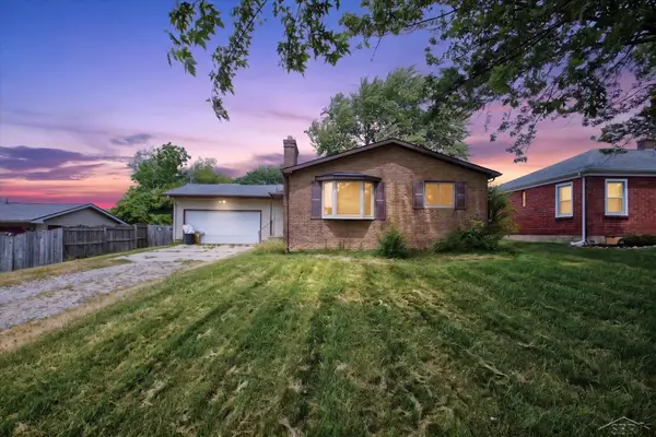
1556 W Gilford, Caro, MI 48723
MLS# 50216222Listed by: JPAR - GREAT LAKES BAY REGION
 $249,900Active4 beds 2 baths2,284 sq. ft.
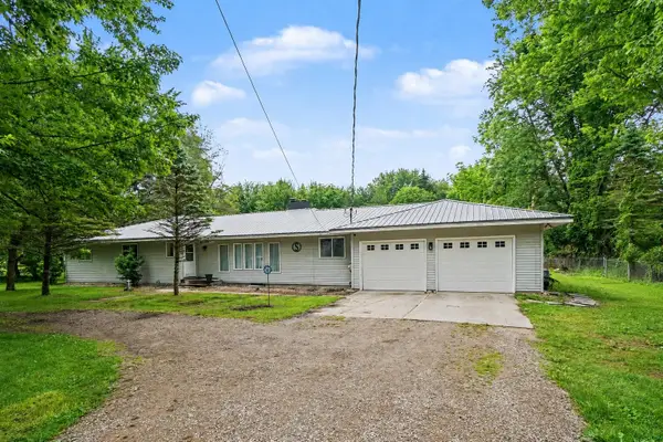
1469 S Colling Road, Caro, MI 48723
MLS# 50213128Listed by: RE/MAX RESULTS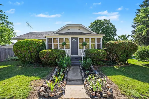 $162,000Pending3 beds 2 baths1,536 sq. ft.
429 S Almer, Caro, MI 48723
MLS# 50212695Listed by: RE/MAX RESULTS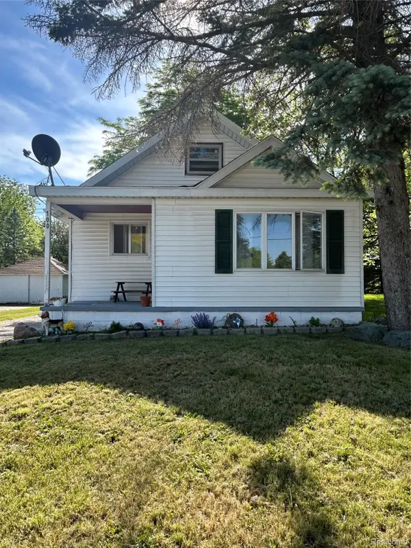 $99,500Pending1 beds 1 baths943 sq. ft.
100 S Hooper Street, Caro, MI 48723
MLS# 20261041608Listed by: REAL ESTATE ONE-CARO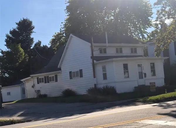 $109,900Pending3 beds 1 baths1,590 sq. ft.
608 E Frank Street, Caro, MI 48723
MLS# 20261033206Listed by: J MCLEOD REALTY, INC-CARO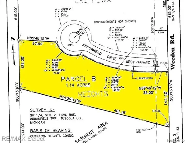 $39,900Active1.14 Acres
0 Weeden Road, Caro, MI 48723
MLS# 20261027468Listed by: RE/MAX SELECT $99,900Active10.3 Acres
0000 S Plain, Caro, MI 48723
MLS# 5050204701Listed by: REMAX PRIME PROPERTIES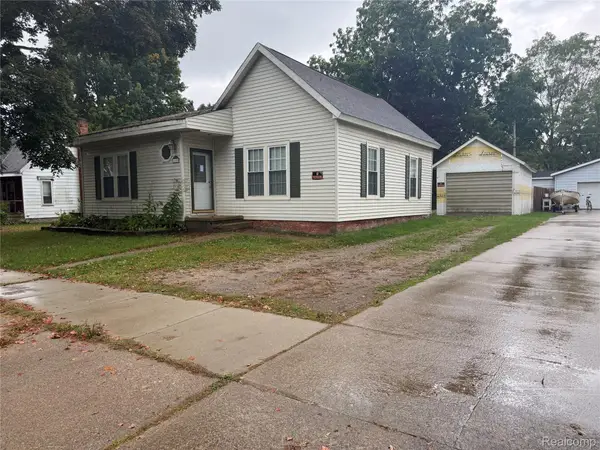 $159,000Active3 beds 1 baths1,500 sq. ft.
140 Alexander Street, Caro, MI 48723
MLS# 20261020546Listed by: KELLER WILLIAMS REALTY-GREAT LAKES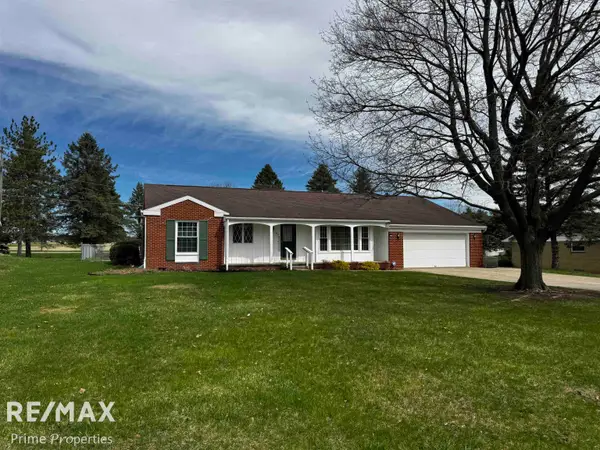 $305,900Pending3 beds 3 baths1,820 sq. ft.
96 Rodd, Caro, MI 48723
MLS# 50202393Listed by: REMAX PRIME PROPERTIES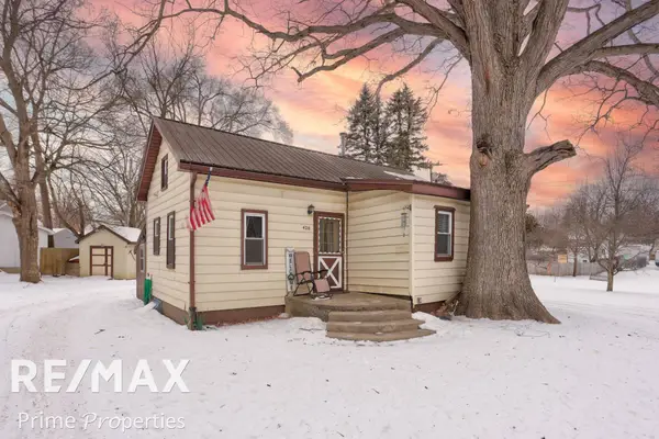 $99,900Pending2 beds 1 baths722 sq. ft.
426 Bates ST, Caro, MI 48723
MLS# 5050199426Listed by: REMAX PRIME PROPERTIES
Local realty services provided by:CENTURY 21 Northland, CENTURY 21 Signature Realty
Neighborhoods near Caro, MI
Zip codes near Caro, MI
- 48435 homes for sale
- 48453 homes for sale
- 48461 homes for sale
- 48464 homes for sale
- 48701 homes for sale
- 48723 homes for sale
- 48726 homes for sale
- 48727 homes for sale
- 48732 homes for sale
- 48733 homes for sale
- 48734 homes for sale
- 48741 homes for sale
- 48744 homes for sale
- 48746 homes for sale
- 48747 homes for sale
- 48754 homes for sale
- 48757 homes for sale
- 48759 homes for sale
- 48760 homes for sale
- 48768 homes for sale
Popular searches near Caro, MI
- Akron homes for sale
- Akron Township homes for sale
- Cass City homes for sale
- Dayton homes for sale
- Denmark homes for sale
- Fairgrove Township homes for sale
- Fairgrove homes for sale
- Fremont homes for sale
- Indianfields homes for sale
- Juniata homes for sale
- Kingston township homes for sale
- Kingston homes for sale
- Koylton homes for sale
- Mayville homes for sale
- Novesta homes for sale
- Silverwood homes for sale
- Vassar homes for sale
- Vassar Township homes for sale
- Watertown homes for sale
- Wells homes for sale
Protect your home and budget from life's surprises with an Assurant Home Warranty, backed by a partner that supports you through every step of homeownership. Explore Plans.
©2026 Century 21 Real Estate LLC. All rights reserved. CENTURY 21®, the CENTURY 21 Logo and C21® are service marks owned by Century 21 Real Estate LLC. Century 21 Real Estate LLC fully supports the principles of the Fair Housing Act and the Equal Opportunity Act. Each office is independently owned and operated. Listing information is deemed reliable but not guaranteed accurate.