- Capitol Hill, Little Rock homes for sale
- Capitol View, Little Rock homes for sale
- Downtown Little Rock, Little Rock homes for sale
- Dunbar School, Little Rock homes for sale
- Evergreen, Little Rock homes for sale
- Gap Creek, Sherwood homes for sale
- Governor's Mansion, Little Rock homes for sale
- Hanger Hill, Little Rock homes for sale
- Heights, Little Rock homes for sale
- Hillcrest, Little Rock homes for sale
- Kingwood, Little Rock homes for sale
- Macarthur Park, Little Rock homes for sale
- Pettaway, Little Rock homes for sale
- Piedmont, Little Rock homes for sale
- Pine To Woodrow, Little Rock homes for sale
- Pulaski Heights, Little Rock homes for sale
- Quapaw Quarter, Little Rock homes for sale
- River Market, Little Rock homes for sale
- Stephens Area Faith, Little Rock homes for sale
- Wright Avenue, Little Rock homes for sale
Sherwood, AR - homes for sale
163 of 163 results displayed
- New
 $175,000Active3 beds 2 baths1,176 sq. ft.
15 Algonkin Place, Sherwood, AR 72120
MLS# 26011930Listed by: IREALTY ARKANSAS - SHERWOOD - New
 $124,900Active1 beds 2 baths1,016 sq. ft.
5914 Tammy Lane, North Little Rock, AR 72117
MLS# 26011826Listed by: RE/MAX HOMEFINDERS - New
 $554,900Active4 beds 4 baths2,954 sq. ft.
1008 Sussix Loop, Sherwood, AR 72120
MLS# 26011834Listed by: LISTWITHFREEDOM.COM, INC. - New
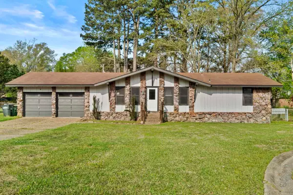
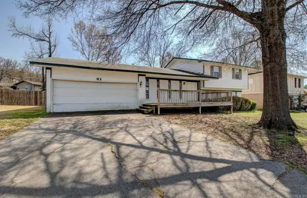 $218,000Active4 beds 2 baths2,031 sq. ft.
61 Cardinal Valley Drive, Sherwood, AR 72120
MLS# 26011801Listed by: CBRPM MAUMELLE - New
 $359,900Active4 beds 3 baths2,516 sq. ft.
205 Birnham Cove, Sherwood, AR 72116
MLS# 26011590Listed by: PORCHLIGHT REALTY - NLR - New
 $224,900Active3 beds 2 baths1,300 sq. ft.
213 Hollywood Avenue, Sherwood, AR 72120
MLS# 26011476Listed by: MICHELE PHILLIPS & CO. REALTORS - New
 $169,000Active3 beds 2 baths1,160 sq. ft.
8908 Merrymen Road, Sherwood, AR 72120
MLS# 26011401Listed by: CRYE-LEIKE REALTORS MAUMELLE - New
 $1,350,000Active4 beds 5 baths4,412 sq. ft.
1720 Kellogg Acres Road, Sherwood, AR 72120
MLS# 26011289Listed by: JANET JONES COMPANY - New
 $399,900Active4 beds 3 baths2,771 sq. ft.
2117 Ingleside Drive, Sherwood, AR 72120
MLS# 26011153Listed by: CRYE-LEIKE REALTORS NLR BRANCH - New
 $524,900Active4 beds 4 baths3,176 sq. ft.
9833 Oak Heights Drive, Sherwood, AR 72027
MLS# 26011027Listed by: MCKIMMEY ASSOCIATES REALTORS NLR - New
 $169,900Active3 beds 2 baths1,668 sq. ft.
8210 Park Ave, Sherwood, AR 72120
MLS# 26010736Listed by: LOTUS REALTY - New
 $164,900Active3 beds 2 baths1,482 sq. ft.
8713 Merrymen Road, Sherwood, AR 72120
MLS# 26010678Listed by: MICHELE PHILLIPS & CO. REALTORS - New
 $225,000Active3 beds 2 baths1,475 sq. ft.
213 Greenwood Avenue, Sherwood, AR 72120
MLS# 26010632Listed by: KELLER WILLIAMS REALTY - New
 $535,000Active4 beds 3 baths2,748 sq. ft.
10067 Hidden Circle, Sherwood, AR 72120
MLS# 26010529Listed by: PORCHLIGHT REALTY - New
 $407,500Active4 beds 3 baths2,306 sq. ft.
9033 Wooddale Drive, Sherwood, AR 72120
MLS# 26010515Listed by: MICHELE PHILLIPS & COMPANY, REALTORS - BENTON BRANCH - New
 $475,000Active4 beds 3 baths3,742 sq. ft.
5912 North Hills Blvd, North Little Rock, AR 72116
MLS# 26010496Listed by: CRYE-LEIKE REALTORS NLR BRANCH  $285,500Active3 beds 2 baths1,670 sq. ft.
7155 Park Meadows Drive, Sherwood, AR 72120
MLS# 26010299Listed by: MICHELE PHILLIPS & CO. REALTORS $442,500Active4 beds 3 baths2,627 sq. ft.
6701 Waterview Pl, Sherwood, AR 72120
MLS# 26010270Listed by: CRYE-LEIKE REALTORS NLR BRANCH $400,000Active4 beds 3 baths2,280 sq. ft.
1717 Creekview, Sherwood, AR 72120
MLS# 26010189Listed by: KELLER WILLIAMS REALTY $429,900Active4 beds 3 baths2,187 sq. ft.
1304 E Maryland Avenue, Sherwood, AR 72120
MLS# 26010162Listed by: IREALTY ARKANSAS - SHERWOOD $284,900Active3 beds 2 baths2,349 sq. ft.
322 E Lee Avenue, Sherwood, AR 72120
MLS# 26010019Listed by: LOTUS REALTY $454,000Active3 beds 2 baths2,376 sq. ft.
596 Valley Oak Drive, Sherwood, AR 72120
MLS# 26009892Listed by: MICHELE PHILLIPS & CO. REALTORS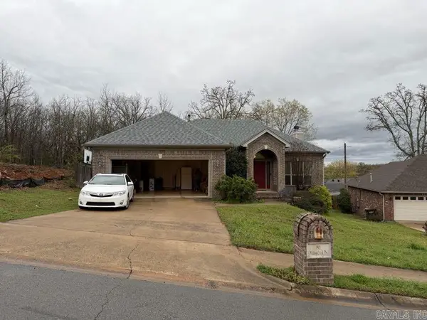 $235,000Active3 beds 2 baths1,874 sq. ft.
1901 Hidden Creek Drive, Sherwood, AR 72120
MLS# 26009822Listed by: MID SOUTH REALTY $359,900Active3 beds 2 baths2,023 sq. ft.
8025 Austin Gardens Court, Sherwood, AR 72120
MLS# 26009682Listed by: CRYE-LEIKE REALTORS KANIS BRANCH $525,000Active3 beds 3 baths3,385 sq. ft.
3241 Clearwater Ct, Sherwood, AR 72120
MLS# 26009592Listed by: YOUNG HOME SALES $265,000Active3 beds 3 baths1,440 sq. ft.
Address Withheld By Seller, Sherwood, AR 72120
MLS# 26009505Listed by: RE/MAX ENCORE - NLR $225,000Active4 beds 2 baths1,516 sq. ft.
6633 Magnolia Way, North Little Rock, AR 72117
MLS# 26009450Listed by: BERKSHIRE HATHAWAY HOMESERVICES ARKANSAS REALTY $249,900Active3 beds 2 baths1,456 sq. ft.
212 Pineview Avenue, Sherwood, AR 72120
MLS# 26009344Listed by: MICHELE PHILLIPS & CO. REALTORS $249,900Active3 beds 2 baths1,456 sq. ft.
214 Pineview Avenue, Sherwood, AR 72120
MLS# 26009345Listed by: MICHELE PHILLIPS & CO. REALTORS $115,000Active2 beds 1 baths672 sq. ft.
215 Taylor Road, Jacksonville, AR 72076
MLS# 26009264Listed by: BIAS 4 U REALTY $599,000Active5 beds 4 baths3,659 sq. ft.
9811 Miller Rd, Sherwood, AR 72120
MLS# 26009076Listed by: IREALTY ARKANSAS - SHERWOOD $249,900Active3 beds 2 baths1,420 sq. ft.
215 Indianhead Drive, Sherwood, AR 72120
MLS# 26009087Listed by: REALTY ONE GROUP LOCK AND KEY $364,000Active3 beds 2 baths1,927 sq. ft.
1009 Oak Forest Circle, Sherwood, AR 72120
MLS# 26008890Listed by: CHARLOTTE JOHN COMPANY (LITTLE ROCK) $225,000Active3 beds 2 baths1,466 sq. ft.
7809 Hayley Drive, Sherwood, AR 72120
MLS# 26008726Listed by: OWNIT GLOBAL PROPERTY GROUP $399,000Active4 beds 3 baths2,214 sq. ft.
9500 Cliffside, Sherwood, AR 72120
MLS# 26008594Listed by: MCKIMMEY ASSOCIATES, REALTORS - 50 PINE $219,900Active3 beds 2 baths1,819 sq. ft.
Address Withheld By Seller, Sherwood, AR 72120
MLS# 26008518Listed by: MCKIMMEY ASSOCIATES REALTORS NLR $519,900Active4 beds 4 baths2,832 sq. ft.
9933 Laurel Oak, Sherwood, AR 72120
MLS# 26008249Listed by: LPT REALTY NLR $100,000Active3 beds 2 baths1,190 sq. ft.
17 Villas Drive, Sherwood, AR 72120
MLS# 26008238Listed by: TRAMMELL & COMPANY REAL ESTATE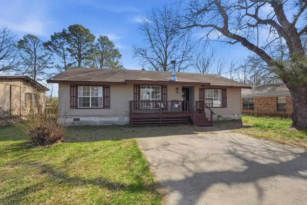 $145,000Active3 beds 2 baths1,284 sq. ft.
12 Fra Mar Drive, Sherwood, AR 72076
MLS# 26008214Listed by: IREALTY ARKANSAS - SHERWOOD $249,900Active3 beds 2 baths1,876 sq. ft.
4 Briarstone Drive, Sherwood, AR 72120
MLS# 26008216Listed by: SIGNATURE PROPERTIES $189,000Active3 beds 2 baths1,370 sq. ft.
5425 Pin Oak Lane, North Little Rock, AR 72117
MLS# 26008205Listed by: MCKIMMEY ASSOCIATES REALTORS NLR $380,000Active4 beds 2 baths2,586 sq. ft.
6949 Austin Bay Court, Sherwood, AR 72120
MLS# 26008102Listed by: CRYE-LEIKE REALTORS CABOT BRANCH $200,000Active3 beds 2 baths1,314 sq. ft.
Address Withheld By Seller, Sherwood, AR 72120
MLS# 26007912Listed by: LPT SELLING LUXURY $219,900Active4 beds 2 baths1,560 sq. ft.
5809 Pin Oak Lane, North Little Rock, AR 72117
MLS# 26007933Listed by: TRUMAN BALL REAL ESTATE $239,800Active3 beds 2 baths2,408 sq. ft.
1421 Hatcher Road, Sherwood, AR 72120
MLS# 26007844Listed by: RIVER TRAIL PROPERTIES $225,000Active4 beds 2 baths1,545 sq. ft.
5708 Little Elm Ln Lane, Sherwood, AR 72117
MLS# 26007859Listed by: IREALTY ARKANSAS - LR $285,000Active4 beds 2 baths1,988 sq. ft.
17109 Crooked Oak Drive, Sherwood, AR 72120
MLS# 26007800Listed by: REALTY ONE GROUP LOCK AND KEY $224,900Active3 beds 2 baths1,575 sq. ft.
6716 Ridgemist Lane, North Little Rock, AR 72117
MLS# 26007786Listed by: LPT REALTY NLR $339,900Active3 beds 2 baths2,423 sq. ft.
616 E Woodruff Avenue, Sherwood, AR 72120
MLS# 26007737Listed by: KELLER WILLIAMS REALTY $264,900Active3 beds 3 baths2,175 sq. ft.
1224 Cornflower, Sherwood, AR 72120
MLS# 26007738Listed by: MCKIMMEY ASSOCIATES REALTORS NLR $232,500Active4 beds 2 baths1,500 sq. ft.
6616 Trammel Estates Lane, Sherwood, AR 72117
MLS# 26007681Listed by: YOUNG HOME SALES $200,000Active3 beds 3 baths1,655 sq. ft.
601 Hillcrest Road, Sherwood, AR 72120
MLS# 26007661Listed by: REALTY ONE GROUP - PINNACLE $385,000Active4 beds 3 baths2,303 sq. ft.
9117 Johnson Drive, Sherwood, AR 72120
MLS# 26007642Listed by: DAWN REALTY $364,900Active4 beds 4 baths3,064 sq. ft.
5916 North Hills Boulevard, Sherwood, AR 72116
MLS# 25049953Listed by: KELLER WILLIAMS REALTY $320,000Active3 beds 2 baths2,290 sq. ft.
30 Campden Hill Road, Sherwood, AR 72120
MLS# 26007579Listed by: EPIC REAL ESTATE $220,000Active3 beds 3 baths1,837 sq. ft.
16 Thornhill Drive, Sherwood, AR 72120
MLS# 26007367Listed by: KELLER WILLIAMS REALTY $210,000Active3 beds 2 baths2,135 sq. ft.
7 Custer Place, Sherwood, AR 72120
MLS# 26007189Listed by: IREALTY ARKANSAS - SHERWOOD $159,900Active3 beds 2 baths1,355 sq. ft.
922 W Kiehl Avenue, Sherwood, AR 72120
MLS# 26007146Listed by: LISTWITHFREEDOM.COM, INC. $507,360Active3 beds 3 baths2,416 sq. ft.
1206 Fern Ridge Road, Sherwood, AR 72120
MLS# 26007126Listed by: MICHELE PHILLIPS & CO. REALTORS $526,680Active4 beds 3 baths2,508 sq. ft.
1173 Fern Ridge Road, Sherwood, AR 72120
MLS# 26007129Listed by: MICHELE PHILLIPS & CO. REALTORS $236,500Active3 beds 2 baths1,810 sq. ft.
43 Falcon Drive, Sherwood, AR 72120
MLS# 26006790Listed by: LPT REALTY $319,900Active3 beds 2 baths1,825 sq. ft.
1917 Hidden Creek Drive, Sherwood, AR 72120
MLS# 26006750Listed by: MCKIMMEY ASSOCIATES REALTORS NLR $429,950Active3 beds 3 baths2,420 sq. ft.
9524 Millers Garden Cove, Sherwood, AR 72120
MLS# 26006751Listed by: THE SUMBLES TEAM KELLER WILLIAMS REALTY $489,500Active4 beds 3 baths2,940 sq. ft.
9216 Rapid Water Drive, Sherwood, AR 72120
MLS# 26006752Listed by: MICHELE PHILLIPS & CO. REALTORS $238,000Active4 beds 2 baths1,796 sq. ft.
1106 Abercorn Place, Sherwood, AR 72120
MLS# 26006652Listed by: EDGE REALTY $235,000Active3 beds 2 baths1,690 sq. ft.
304 S Longfield Avenue, Sherwood, AR 72120
MLS# 26006595Listed by: MICHELE PHILLIPS & CO. REALTORS $229,000Active3 beds 2 baths2,088 sq. ft.
312 Eubanks Road, Jacksonville, AR 72076
MLS# 26006578Listed by: LPT REALTY $354,900Active3 beds 3 baths2,521 sq. ft.
7365 W Ridge Circle, Sherwood, AR 72120
MLS# 26006549Listed by: EPIQUE REALTY $359,900Active4 beds 2 baths2,278 sq. ft.
116 Obsidian Dr., Sherwood, AR 72120
MLS# 26006516Listed by: CRYE-LEIKE REALTORS NLR BRANCH $281,900Active3 beds 2 baths1,937 sq. ft.
19 Post Oak Loop, Sherwood, AR 72120
MLS# 26006203Listed by: EDGE REALTY $375,000Active4 beds 3 baths2,528 sq. ft.
7124 E Ridge Drive, Sherwood, AR 72120
MLS# 26006201Listed by: THE LEGACY TEAM $185,000Active3 beds 2 baths1,259 sq. ft.
71 Cinnamon Drive, Sherwood, AR 72120
MLS# 26006103Listed by: EXP REALTY $374,900Active4 beds 3 baths2,217 sq. ft.
6832 Austin Harbor Loop, Sherwood, AR 72120
MLS# 26006115Listed by: RE/MAX PROPERTIES $218,900Active3 beds 2 baths1,936 sq. ft.
105 Glenora Avenue, Sherwood, AR 72120
MLS# 26006026Listed by: HOWELL REALTY PROS $209,900Active3 beds 2 baths1,535 sq. ft.
208 Elwood Dr, Sherwood, AR 72120
MLS# 26005971Listed by: CBRPM GROUP $399,900Active4 beds 2 baths2,223 sq. ft.
933 Millers Glen Drive, Sherwood, AR 72120
MLS# 26005704Listed by: CRYE-LEIKE REALTORS CABOT BRANCH $409,000Active4 beds 2 baths2,424 sq. ft.
6772 Austin Harbor Loop, Sherwood, AR 72120
MLS# 26005695Listed by: MICHELE PHILLIPS & CO. REALTORS $649,900Active5 beds 5 baths3,637 sq. ft.
9109 Wooded Acres, Sherwood, AR 72120
MLS# 26005590Listed by: RE/MAX HOMEFINDERS $219,500Active3 beds 2 baths2,091 sq. ft.
6103 Woodview Drive, Sherwood, AR 72120
MLS# 26005523Listed by: COOK AND COMPANY $139,900Active3 beds 2 baths1,514 sq. ft.
208 Calloway Avenue, Sherwood, AR 72120
MLS# 26005230Listed by: PORCHLIGHT REALTY $314,900Active3 beds 2 baths2,164 sq. ft.
796 Lake Tree Lane, Sherwood, AR 72120
MLS# 26005235Listed by: MICHELE PHILLIPS & CO. REALTORS $339,900Active3 beds 2 baths2,207 sq. ft.
1925 Oakbrook, Sherwood, AR 72120
MLS# 26005208Listed by: CRYE-LEIKE REALTORS NLR BRANCH $220,000Active4 beds 2 baths1,535 sq. ft.
Address Withheld By Seller, Sherwood, AR 72117
MLS# 26004936Listed by: VR INVESTMENTS REALTY $229,000Active3 beds 2 baths1,407 sq. ft.
20 Lenox Road, Sherwood, AR 72120
MLS# 26004926Listed by: REALTY ONE GROUP LOCK AND KEY $385,000Active4 beds 3 baths2,172 sq. ft.
2700 E Maryland Avenue, Sherwood, AR 72120
MLS# 26004805Listed by: MICHELE PHILLIPS & CO. REALTORS $444,900Active4 beds 3 baths2,335 sq. ft.
556 Valley Oak Drive, Sherwood, AR 72120
MLS# 26004185Listed by: PORCHLIGHT REALTY $399,900Active5 beds 3 baths3,250 sq. ft.
33 Narragansett Place, Sherwood, AR 72120
MLS# 26004196Listed by: CAPITAL REAL ESTATE ADVISORS $165,000Active4 beds 2 baths1,170 sq. ft.
29 Compass Point, Sherwood, AR 72120
MLS# 26003399Listed by: DREAM SPACE REALTY GROUP $155,000Active3 beds 3 baths2,386 sq. ft.
Address Withheld By Seller, Sherwood, AR 72120
MLS# 26003300Listed by: MASON AND COMPANY $175,000Active2 beds 1 baths972 sq. ft.
11005 Jacksonville Cato Road, Sherwood, AR 72120
MLS# 26003146Listed by: JANET JONES COMPANY $375,000Active4 beds 3 baths2,286 sq. ft.
3609 Westshore Drive, Sherwood, AR 72120
MLS# 26002957Listed by: CRYE-LEIKE REALTORS FINANCIAL CENTRE BRANCH $409,900Active4 beds 3 baths2,354 sq. ft.
861 Oak Forest Circle, Sherwood, AR 72120
MLS# 26002941Listed by: CRYE-LEIKE REALTORS CABOT BRANCH $195,000Active3 beds 2 baths1,242 sq. ft.
Address Withheld By Seller, Sherwood, AR 72120
MLS# 26002869Listed by: MCKIMMEY ASSOCIATES REALTORS NLR $385,500Active3 beds 2 baths2,228 sq. ft.
885 Oak Forest Circle, Sherwood, AR 72120
MLS# 26002471Listed by: ENGEL & VOLKERS $533,000Active4 beds 3 baths2,600 sq. ft.
10126 Hidden Circle, Sherwood, AR 72120
MLS# 26002418Listed by: MICHELE PHILLIPS & CO. REALTORS $216,000Active3 beds 2 baths1,475 sq. ft.
8602 Patricia Lynn Lane, Sherwood, AR 72120
MLS# 26002365Listed by: ENGEL & VOLKERS $244,900Active3 beds 2 baths1,639 sq. ft.
22 Pennwood Drive, Sherwood, AR 72120
MLS# 26002330Listed by: IREALTY ARKANSAS - SHERWOOD $185,000Active3 beds 2 baths1,686 sq. ft.
110 Ann Avenue, Sherwood, AR 72120
MLS# 26002280Listed by: EPIQUE REALTY $235,000Active3 beds 3 baths2,390 sq. ft.
8812 Holiday Drive, Sherwood, AR 72120
MLS# 26002119Listed by: IREALTY ARKANSAS - SHERWOOD $329,855Active3 beds 2 baths1,783 sq. ft.
9 Valewood Court, Sherwood, AR 72076
MLS# 26002017Listed by: MICHELE PHILLIPS & CO. REALTORS $385,000Active4 beds 2 baths2,808 sq. ft.
21 Eagle Point Drive, Sherwood, AR 72120
MLS# 26001756Listed by: PORCHLIGHT REALTY $409,900Active4 beds 2 baths2,130 sq. ft.
629 Valley Oak Drive, Sherwood, AR 72120
MLS# 26001701Listed by: MICHELE PHILLIPS & CO. REALTORS $225,000Active3 beds 2 baths1,743 sq. ft.
16 Glenbrook Place, Sherwood, AR 72120
MLS# 26001374Listed by: RE/MAX HOMEFINDERS $115,000Active2 beds 1 baths875 sq. ft.
12 Lenox Road, Sherwood, AR 72120
MLS# 26001009Listed by: SIMPLI HOM $179,999Active3 beds 2 baths1,128 sq. ft.
7 Creekridge Circle, Sherwood, AR 72120
MLS# 26009354Listed by: MICHELE PHILLIPS & CO. REALTORS $309,900Active3 beds 2 baths1,715 sq. ft.
1624 Hidden Creek Drive, Sherwood, AR 72120
MLS# 26000926Listed by: IREALTY ARKANSAS - SHERWOOD $375,000Active3 beds 2 baths2,073 sq. ft.
8340 Sapphire Cove, Sherwood, AR 72120
MLS# 26000336Listed by: MICHELE PHILLIPS & CO. REALTORS $267,500Active3 beds 2 baths2,188 sq. ft.
926 Karla Circle, Sherwood, AR 72120
MLS# 26000334Listed by: MICHELE PHILLIPS & CO. REALTORS $364,000Active4 beds 2 baths2,111 sq. ft.
9009 Wooddale Dr, Sherwood, AR 72120
MLS# 26000008Listed by: IREALTY ARKANSAS - SHERWOOD $180,000Active4 beds 2 baths1,488 sq. ft.
406 Ridgelea Ave, Sherwood, AR 72120
MLS# 25049987Listed by: ENGEL & VOLKERS $167,500Active3 beds 2 baths1,623 sq. ft.
39 Sheraton Oaks Drive, Sherwood, AR 72120
MLS# 25049925Listed by: MID SOUTH REALTY $160,000Active3 beds 2 baths1,211 sq. ft.
10 Foxgrove Lane, Sherwood, AR 72120
MLS# 25049621Listed by: LIVE.LOVE.ARKANSAS REALTY GROUP $255,000Active4 beds 3 baths2,125 sq. ft.
8801 Patricia Lynn Lane, Sherwood, AR 72120
MLS# 25049607Listed by: LPT REALTY $315,500Active3 beds 2 baths2,100 sq. ft.
7328 W Ridge Circle, Sherwood, AR 72120
MLS# 25049489Listed by: TODD ARMSTRONG REAL ESTATE $320,000Active4 beds 2 baths2,113 sq. ft.
9138 Cliffside Dr, Sherwood, AR 72120
MLS# 25049279Listed by: CBRPM GROUP $256,000Active3 beds 2 baths1,605 sq. ft.
5013 Willow Glen Circle, Sherwood, AR 72120
MLS# 25049103Listed by: CRYE-LEIKE REALTORS MAUMELLE $185,000Active3 beds 2 baths1,660 sq. ft.
1205 Dyson Drive, Sherwood, AR 72120
MLS# 25049040Listed by: TAYLOR REALTY GROUP HSV $583,000Active4 beds 3 baths2,789 sq. ft.
1197 Fern Ridge, Sherwood, AR 72120
MLS# 25049054Listed by: IREALTY ARKANSAS - SHERWOOD $489,000Active3 beds 2 baths2,346 sq. ft.
Address Withheld By Seller, Sherwood, AR 72120
MLS# 25049055Listed by: IREALTY ARKANSAS - SHERWOOD $489,000Active3 beds 2 baths2,346 sq. ft.
Address Withheld By Seller, Sherwood, AR 72120
MLS# 25049056Listed by: IREALTY ARKANSAS - SHERWOOD $159,900Active3 beds 2 baths1,224 sq. ft.
269 Kelso Road, Sherwood, AR 72076
MLS# 25048980Listed by: IREALTY ARKANSAS - CABOT $470,000Active4 beds 3 baths3,339 sq. ft.
1916 Oakbrook Dr, Sherwood, AR 72120
MLS# 25048816Listed by: IREALTY ARKANSAS - SHERWOOD $464,900Active4 beds 3 baths2,505 sq. ft.
2243 E Maryland Ave, Sherwood, AR 72120
MLS# 26009748Listed by: MICHELE PHILLIPS & CO. REALTORS $598,900Active4 beds 4 baths3,583 sq. ft.
8908 Stillwater Road, Sherwood, AR 72120
MLS# 25048617Listed by: SIMPLI HOM $340,000Active4 beds 4 baths3,724 sq. ft.
101 Red River Drive, Sherwood, AR 72120
MLS# 25048452Listed by: IREALTY ARKANSAS - SHERWOOD $397,000Active3 beds 3 baths2,223 sq. ft.
Address Withheld By Seller, Sherwood, AR 72120
MLS# 25048344Listed by: REAL ESTATE SOURCES $333,000Active3 beds 2 baths1,825 sq. ft.
Address Withheld By Seller, Sherwood, AR 72120
MLS# 25048347Listed by: REAL ESTATE SOURCES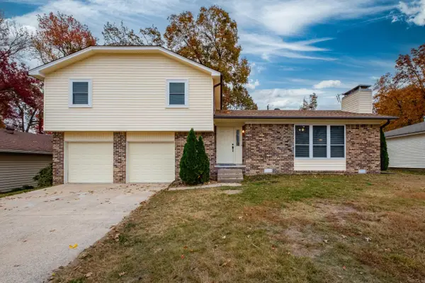 $220,000Active3 beds 2 baths1,457 sq. ft.
801 Autumnbrook Circle, Sherwood, AR 72120
MLS# 25047402Listed by: ADKINS & ASSOCIATES REAL ESTATE $368,400Active3 beds 3 baths3,306 sq. ft.
1505 Hawkwood Road, Sherwood, AR 72120
MLS# 25047121Listed by: REAL PROPERTY MANAGEMENT CENTRAL AR $485,000Active5 beds 5 baths3,868 sq. ft.
200 Fork River Road, Sherwood, AR 72120
MLS# 26005835Listed by: MICHELE PHILLIPS & CO. REALTORS $296,000Active4 beds 2 baths1,885 sq. ft.
3073 Woodruff Creek Drive, Sherwood, AR 72120
MLS# 25044381Listed by: GREEN REALTY & ASSOCIATES, LLC $479,400Active4 beds 3 baths2,505 sq. ft.
112 Riverstone Cove, Sherwood, AR 72120
MLS# 25044259Listed by: MICHELE PHILLIPS & CO. REALTORS $345,500Active3 beds 2 baths2,247 sq. ft.
3024 Miracle Heights Cove, Sherwood, AR 72120
MLS# 25043381Listed by: TRADEMARK REAL ESTATE, INC.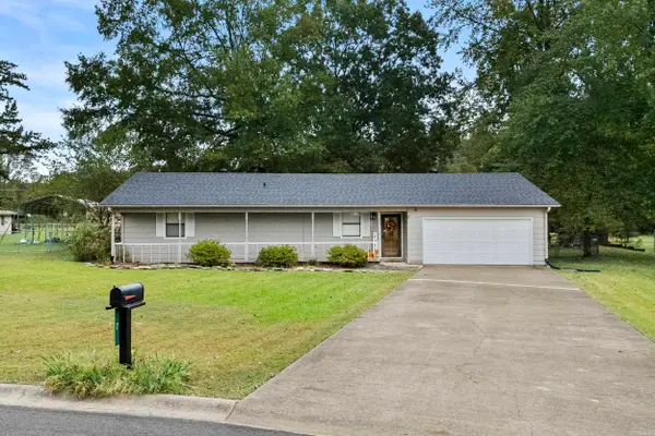 $249,900Active3 beds 2 baths1,463 sq. ft.
7 Valewood Court, Sherwood, AR 72076
MLS# 25042946Listed by: IREALTY ARKANSAS - SHERWOOD $275,000Active3 beds 2 baths2,054 sq. ft.
1503 Hawkwood Drive, Sherwood, AR 72120
MLS# 25042809Listed by: IREALTY ARKANSAS - LR $325,000Active4 beds 3 baths2,480 sq. ft.
2949 Maelstrom Circle, Sherwood, AR 72120
MLS# 26009651Listed by: PORCHLIGHT REALTY $159,900Active3 beds 2 baths1,152 sq. ft.
11440 Jacksonville Cato Road, Sherwood, AR 72120
MLS# 25041725Listed by: RIVER TRAIL PROPERTIES $445,000Active4 beds 3 baths2,328 sq. ft.
564 Valley Oak Drive, Sherwood, AR 72120
MLS# 25040942Listed by: MICHELE PHILLIPS & CO. REALTORS $521,170Active4 beds 3 baths2,743 sq. ft.
656 Feldspar Drive, Sherwood, AR 72120
MLS# 25039676Listed by: MICHELE PHILLIPS & CO. REALTORS $469,900Active4 beds 3 baths2,468 sq. ft.
517 Valley Oak Drive, Sherwood, AR 72120
MLS# 26000046Listed by: MICHELE PHILLIPS & COMPANY, REALTORS-CABOT BRANCH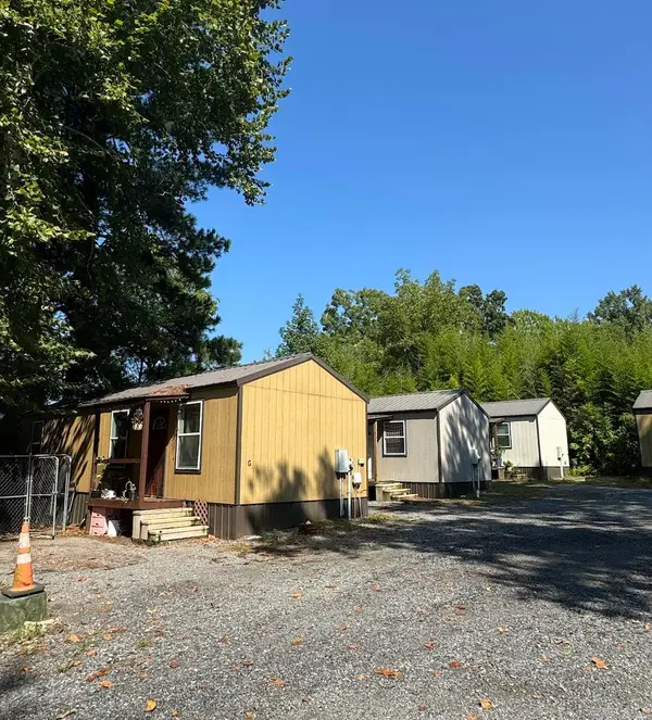 $750,000Active23 beds 13 baths580 sq. ft.
11300 Jacksonville Cato Road, Sherwood, AR 72120
MLS# 25038457Listed by: IREALTY ARKANSAS - SHERWOOD $449,900Active4 beds 7 baths5,288 sq. ft.
701 Club Road, Sherwood, AR 72120
MLS# 25037989Listed by: MCKIMMEY ASSOCIATES REALTORS NLR $100,000Active3 beds 2 baths1,078 sq. ft.
1800 Palomino Drive, Sherwood, AR 72120
MLS# 25037774Listed by: MICHELE PHILLIPS & CO. REALTORS SEARCY BRANCH
 $209,000Active3 beds 2 baths2,740 sq. ft.
8218 Park Ave, Sherwood, AR 72120
MLS# 25037159Listed by: CENTURY 21 PRESTIGE REALTY $145,900Active3 beds 2 baths1,312 sq. ft.
609 Newcastle Dr, Sherwood, AR 72120
MLS# 25037162Listed by: CENTURY 21 PRESTIGE REALTY $189,000Active3 beds 2 baths1,589 sq. ft.
1926 E Lee Avenue, Sherwood, AR 72120
MLS# 26000436Listed by: CRYE-LEIKE REALTORS NLR BRANCH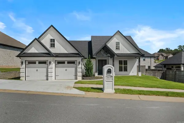 $435,900Active4 beds 3 baths2,490 sq. ft.
1435 Creekview Drive, Sherwood, AR 72120
MLS# 25036619Listed by: IREALTY ARKANSAS - SHERWOOD $159,900Active3 beds 2 baths1,706 sq. ft.
304 Verona Avenue, Sherwood, AR 72120
MLS# 25036586Listed by: LISTWITHFREEDOM.COM, INC. $179,900Active3 beds 2 baths1,560 sq. ft.
42 Jackson Oaks Drive, Sherwood, AR 72120
MLS# 25036066Listed by: CRYE-LEIKE REALTORS NLR BRANCH- New
 $365,850Active4 beds 2 baths1,911 sq. ft.
7216 Stonehenge Drive, Sherwood, AR 72120
MLS# 26010709Listed by: PORCHLIGHT REALTY  $489,900Active4 beds 3 baths2,500 sq. ft.
124 Riverstone Cove, Sherwood, AR 72120
MLS# 26006375Listed by: CRYE-LEIKE REALTORS NLR BRANCH $218,900Active3 beds 3 baths1,561 sq. ft.
9460 Robin Ln, Sherwood, AR 72120
MLS# 26000108Listed by: BAILEY & COMPANY REAL ESTATE $799,900Active5 beds 8 baths5,660 sq. ft.
2116 Little Ridge Court, Sherwood, AR 72120
MLS# 25028676Listed by: KELLCO REAL ESTATE, INC. $237,000Active3 beds 2 baths1,776 sq. ft.
Address Withheld By Seller, Sherwood, AR 72120
MLS# 26003715Listed by: PORCHLIGHT REALTY - NLR $465,000Active4 beds 4 baths2,853 sq. ft.
8918 Williams Drive, Sherwood, AR 72120
MLS# 26000021Listed by: JON UNDERHILL REAL ESTATE $120,000Active3 beds 2 baths1,360 sq. ft.
9318 Woodbine Sttreet, Sherwood, AR 72120
MLS# 25027536Listed by: LOTUS REALTY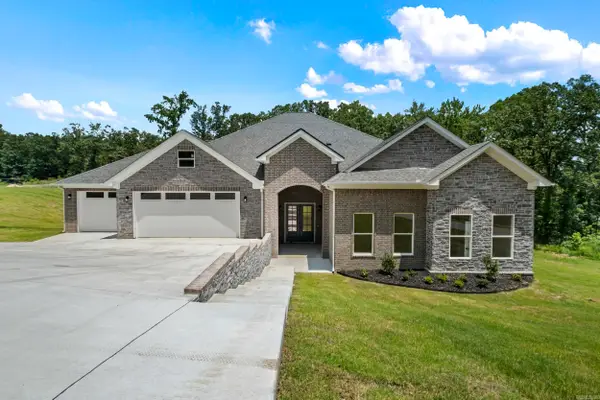 $550,400Active5 beds 4 baths2,960 sq. ft.
8552 Rapid Water Dr, Sherwood, AR 72120
MLS# 25041712Listed by: IREALTY ARKANSAS - SHERWOOD $120,000Active4 beds 2 baths1,976 sq. ft.
Address Withheld By Seller, Sherwood, AR 72120
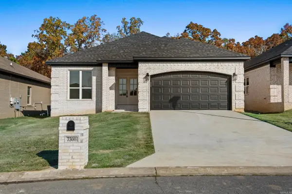
MLS# 25015675Listed by: MASON AND COMPANY- New
 $322,850Active3 beds 2 baths1,902 sq. ft.
7224 Stonehenge Drive, Sherwood, AR 72120
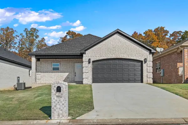
MLS# 26010710Listed by: PORCHLIGHT REALTY - New
 $316,000Active3 beds 2 baths1,859 sq. ft.
7300 Stonehenge Drive, Sherwood, AR 72120
MLS# 26010712Listed by: PORCHLIGHT REALTY  $385,000Active4 beds 2 baths2,560 sq. ft.
Address Withheld By Seller, Mammoth Spring, AR 72554
MLS# 25006935Listed by: VIDEO REAL ESTATE AGENCY $269,900Active3 beds 3 baths1,692 sq. ft.
9732 Acorn Cove, Out of Area, AR 72120
MLS# 115904Listed by: EXP REALTY, LLC- TX $135,000Active3 beds 1 baths1,014 sq. ft.
7914 Bronco Lane, Sherwood, AR 72120
MLS# 26003454Listed by: THE LEGACY TEAM
Local realty services provided by:CENTURY 21 PORTFOLIO, CENTURY 21 Platinum Partners
Neighborhoods near Sherwood, AR
Zip codes near Sherwood, AR
- 72023 homes for sale
- 72076 homes for sale
- 72086 homes for sale
- 72113 homes for sale
- 72114 homes for sale
- 72116 homes for sale
- 72117 homes for sale
- 72118 homes for sale
- 72120 homes for sale
- 72142 homes for sale
- 72199 homes for sale
- 72201 homes for sale
- 72202 homes for sale
- 72204 homes for sale
- 72205 homes for sale
- 72207 homes for sale
- 72209 homes for sale
- 72211 homes for sale
- 72212 homes for sale
- 72227 homes for sale
Popular searches near Sherwood, AR
- Big Rock homes for sale
- Cabot homes for sale
- Cammack Village homes for sale
- Danley homes for sale
- Dortch homes for sale
- Furlow homes for sale
- Gibson homes for sale
- Goodrum homes for sale
- Gray homes for sale
- Hill homes for sale
- Jacksonville homes for sale
- Little Rock homes for sale
- Maumelle homes for sale
- Mayflower homes for sale
- McAlmont homes for sale
- North Little Rock homes for sale
- Palarm homes for sale
- Scott homes for sale
- Wilson homes for sale
- York homes for sale
Protect your home and budget from life's surprises with an Assurant Home Warranty, backed by a partner that supports you through every step of homeownership. Explore Plans.
©2026 Century 21 Real Estate LLC. All rights reserved. CENTURY 21®, the CENTURY 21 Logo and C21® are service marks owned by Century 21 Real Estate LLC. Century 21 Real Estate LLC fully supports the principles of the Fair Housing Act and the Equal Opportunity Act. Each office is independently owned and operated. Listing information is deemed reliable but not guaranteed accurate.