- Amber Crossing, Visalia homes for sale
- Bella Sera, Visalia homes for sale
- Connelly, Visalia homes for sale
- Crestwood, Visalia homes for sale
- Fieldstone Oaks, Visalia homes for sale
- Foxwood Estates, Visalia homes for sale
- Highland, Visalia homes for sale
- Highland Knolls, Bakersfield homes for sale
- Meadow View, Bakersfield homes for sale
- North Bakersfield, Bakersfield homes for sale
- North Country Meadows, Bakersfield homes for sale
- Oakwest, Visalia homes for sale
- Panorama Heights, Bakersfield homes for sale
- Pheasant Ridge, Visalia homes for sale
- Rio Bravo, Bakersfield homes for sale
- Rio Bravo Country Club, Bakersfield homes for sale
- Royal Oaks, Visalia homes for sale
- Silver Oaks, Visalia homes for sale
- The Lakes, Visalia homes for sale
- The Ranch, Visalia homes for sale
Springville, CA - homes for sale
10 of 10 results displayed
 $140,000Active3.42 Acres
Bogart Drive, Springville, CA 93265
MLS# 242886Listed by: DOWNTOWN REALTY $289,000Pending3 beds 2 baths1,377 sq. ft.
35394 Tule River Drive, Springville, CA 93265
MLS# 242870Listed by: MELSON REALTY, INC.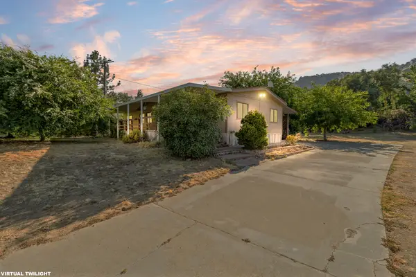
 $315,000Active3 beds 2 baths1,680 sq. ft.
36308 California 190, Springville, CA 93265
MLS# 242614Listed by: CENTURY 21 SELECT REAL ESTATE $309,900Pending3 beds 3 baths1,327 sq. ft.
35228 Lenard Road, Springville, CA 93265
MLS# 242376Listed by: CENTURY 21 SELECT REAL ESTATE- Open Sat, 10:30am to 12:30pm
 $299,900Active2 beds 2 baths1,254 sq. ft.
35823 Rio Vista Road, Springville, CA 93265
MLS# 242241Listed by: EXP REALTY OF GREATER LOS ANGELES, INC. 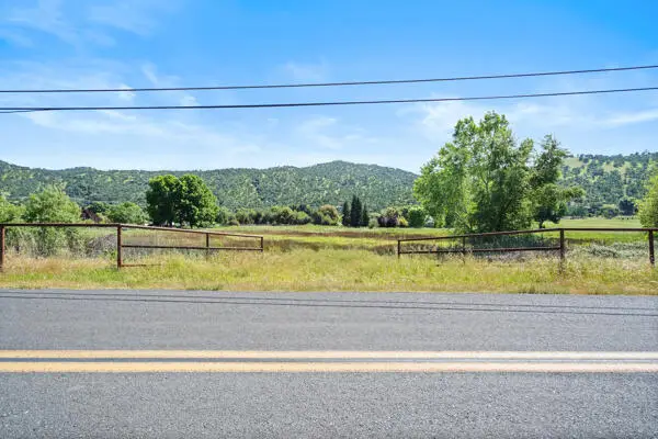 $154,900Active2.41 Acres
Globe Drive, Springville, CA 93265
MLS# 240869Listed by: FIVE STAR REALTY $720,000Active2 beds 2 baths1,960 sq. ft.
34784 Bogart Drive, Springville, CA 93265
MLS# 240293Listed by: DOWNTOWN REALTY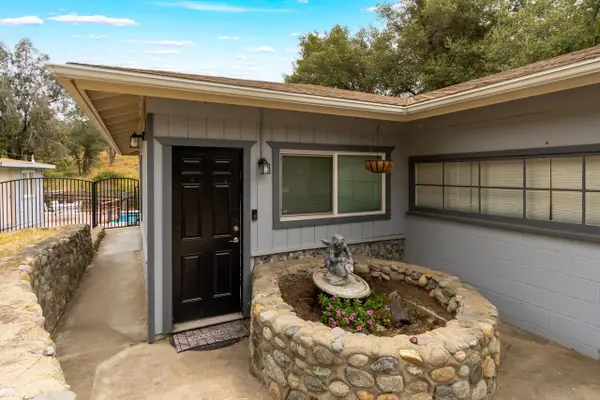 $325,000Pending3 beds 4 baths1,396 sq. ft.
35228 Lenard Road, Springville, CA 93265
MLS# 239799Listed by: AXEN REALTY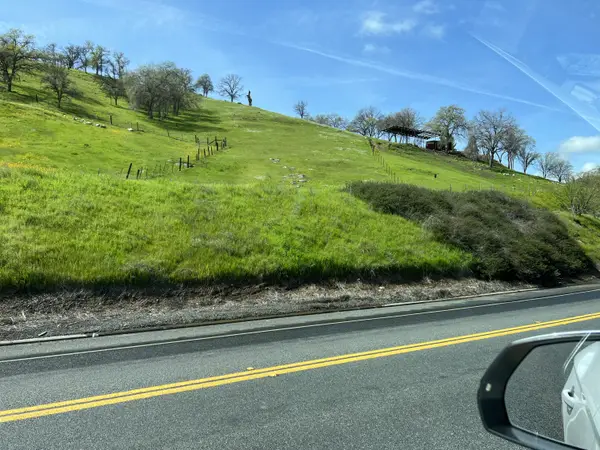 $349,900Active53.86 Acres
0 Highway 190, Springville, CA 93265
MLS# 238681Listed by: AXEN REALTY $499,000Active5 beds 4 baths2,604 sq. ft.
35373 Pine Drive, Springville, CA 93265
MLS# 237971Listed by: BELLA HOMES AND PROPERTIES,INC
Local realty services provided by:CENTURY 21 Select Real Estate, Inc.
Neighborhoods near Springville, CA
Zip codes near Springville, CA
- 93207 homes for sale
- 93215 homes for sale
- 93218 homes for sale
- 93219 homes for sale
- 93221 homes for sale
- 93223 homes for sale
- 93235 homes for sale
- 93238 homes for sale
- 93244 homes for sale
- 93247 homes for sale
- 93256 homes for sale
- 93257 homes for sale
- 93260 homes for sale
- 93265 homes for sale
- 93267 homes for sale
- 93270 homes for sale
- 93271 homes for sale
- 93272 homes for sale
- 93286 homes for sale
- 93292 homes for sale
Popular searches near Springville, CA
- California Hot Springs homes for sale
- Camp Nelson homes for sale
- Ducor homes for sale
- East Porterville homes for sale
- Exeter homes for sale
- Lemon Cove homes for sale
- Lindsay homes for sale
- McClenney Tract homes for sale
- Pierpoint homes for sale
- Pine Flat homes for sale
- Ponderosa homes for sale
- Poplar-Cotton Center homes for sale
- Porterville homes for sale
- Posey homes for sale
- Sequoia Crest homes for sale
- Springville-Johnsondale homes for sale
- Strathmore homes for sale
- Sugarloaf Saw Mill homes for sale
- Terra Bella homes for sale
- Three Rivers homes for sale
Protect your home and budget from life's surprises with an Assurant Home Warranty, backed by a partner that supports you through every step of homeownership. Explore Plans.
©2026 Century 21 Real Estate LLC. All rights reserved. CENTURY 21®, the CENTURY 21 Logo and C21® are service marks owned by Century 21 Real Estate LLC. Century 21 Real Estate LLC fully supports the principles of the Fair Housing Act and the Equal Opportunity Act. Each office is independently owned and operated. Listing information is deemed reliable but not guaranteed accurate.